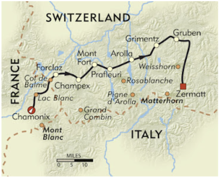
Walkers Haute
Blog post description.
3/30/202651 min read


Stage 1: Chamonix (Hotel Lyret) to Hotel de la Forclaz
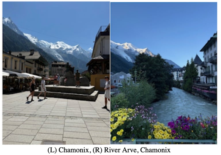
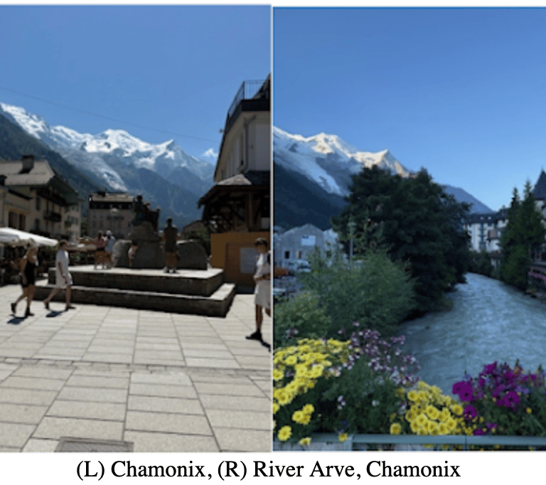
Chamonix France. I’m sure you’ve heard of it. It’s a renowned mountain ski village that sits confidently in the shadow of Mount Blanc. If you haven’t heard of Chamonix, I bet you have heard of Mount Blanc. Standing at 15,777 feet, it’s the highest peak in the Alps and Western Europe. The village of Chamonix is not just beautiful, it’s spectacular. The problem is that everyone knows it. While walking down the busy streets, I couldn’t help but feel like I was late to the party. Everywhere I looked people were spilling out of street corners and alleyways by the hundreds. The low roar of a dozen languages filled the air.
Chamonix was a melting pot adventure paradise. Whatever you’re into, they have it. People flock there to hike, bike, paraglide, white water raft and more. In August, when I was there, adventure was bursting at the seams. Everywhere I looked I saw it. I’ve been to many mountain towns, but Chamonix was a unicorn. It was an adventure destination on steroids. I enjoyed my time there, but after 24 hours I couldn’t wait to escape the crowds and get out into nature.
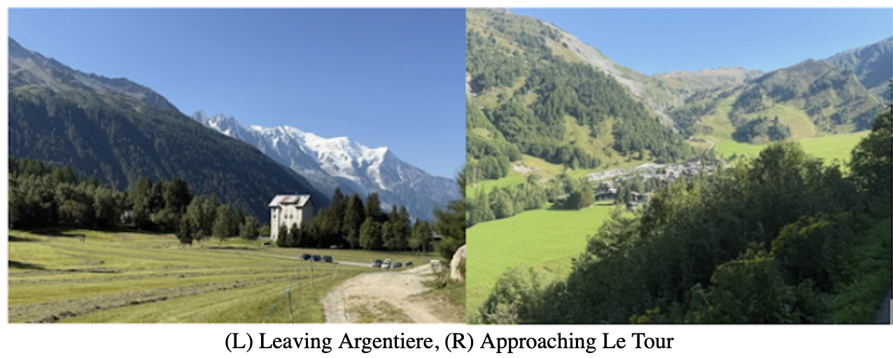
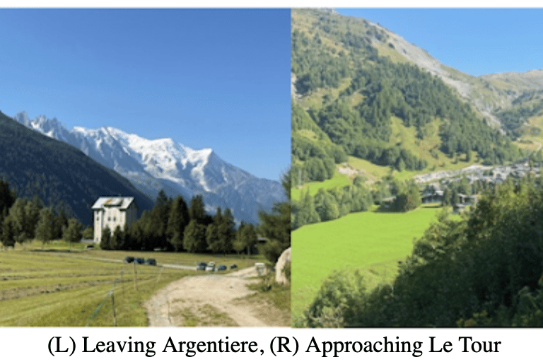
The first stage of the Walkers Haute Route (WHR) sets a northerly course through Chamonix and along the Arve River. The Arve is a picturesque fast flowing river that I would describe as milky green in color. It's odd color gives it character. Combine that with the scenic backdrop of Mount Blanc and you have yourself a picturesque wonderland. It set the scene for a lovely morning and acted as a good warm up for what is to come. The hike gently climbs a high ridge that follows the valley to the small village of Argentiere. Many people stop here on their first day or they bypass Chamonix all together and start in Argentiere. For me it was a pass-through village. From Argentiere the path heads up and away from civilization.
Mount Blanc loomed over me as if watching my every step as I approached the small village of Le Tour. From there, the path goes straight up. There is a Gondola that can bypass this section of hiking which is essentially a path up the mountainside underneath the Gondola. Once past the top station of the Gondola the path takes you to WHR’s first mountain pass, Col de Balme.
The hike up to Col de Balme was not overly difficult. At the top of the pass sits the first mountain hut of the route, Refuge du Col de Balme. The hut was packed with day hikers and Tour de Mount Blanc (TMB) adventurists. The first couple of days were jammed full of TMB hikers as it is the most popular multi-day hike in the area. It’s less intense and shorter than WHR, which means it’s more accessible to everyone. People were spread out on the grassy mountain pass taking pictures and congregating with friends. It was packed. I heard a variety of languages as people eagerly took in the scenery. I was shocked to hear English. American for sure. I approached a group of 5 and asked where they were from. Colorado. In all my time in Italy, I met many people, but not many Americans. Here, on day one of the hike, I met 5 and it wasn’t even noon yet.
I found a flat spot to have a snack and take a brief rest. The views from the Pass were mesmerizing and gave me full confidence that this hike was going to be chalk full of epic scenery. This pass also acts as the border between France and Switzerland. While I enjoyed my brief time in France, I was excited to see what Switzerland had to offer.
The descent down to Le Peuty was one of the most grueling descents of the entire 120-mile trek. It was a never-ending rocky switchback all the way to Le Peuty. A 3858 ft descent is nothing to take lightly, but the terrain was loose rock and required a lot of focus. Getting hurt on day 1 was not an option. Also, Europe was in the middle of a heat wave that was not normal for this area. I felt it early and I felt it often. At this point in the day, it was 78 degrees, and it was barely 1:00PM. Temperatures seemed to max out here at 4PM, so I knew the next few hours would be tough.
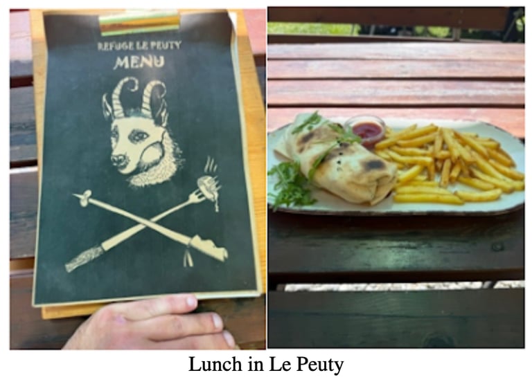
I finally made it to La Peuty, a tiny village that consisted of a couple dozen houses and 1 restaurant. I ate lunch at an outside picnic table and relaxed before my final ascent up to my destination hut, Hotel de la Forclaz. The hike to Forclaz was roughly 2 miles uphill.
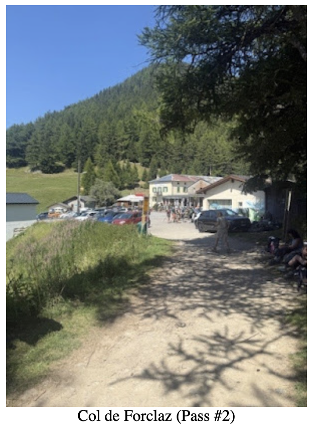
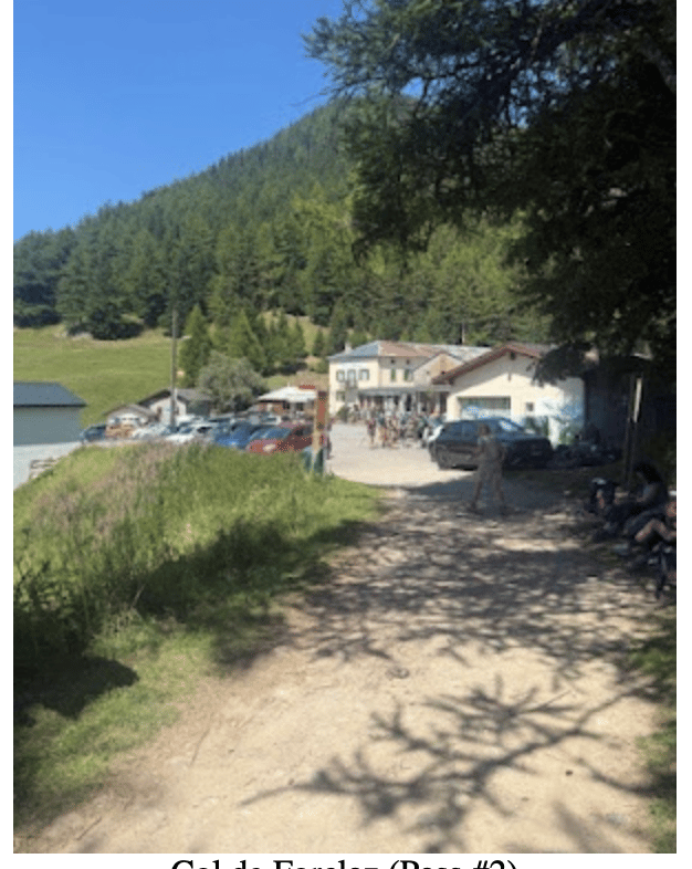
The hotel sat perched on the 2nd mountain pass of the WHR, Col de la Forclaz. I arrived at the hut around 3:30PM. The intensity of the sun felt unnatural this high up on this mountain pass. I sat on the hotel’s patio and sweated profusely while drinking a Radler. Half lemonade, half beer, a Radler was my go-to drink while hiking in the Alps. My first hut of the WHR was a busy one. Large groups of people were eating food or drinking beer after a long day of hiking. A group of 10 American women were sitting at a table with a French guide drinking beers and laughing. They were hiking the Tour de Mount Blanc. I asked them where they were from. Two of the 10 women were from Massachusetts! It was only day one and I had already seen so many Americans. I checked in to the Hut at 4PM. A line queued up as many sweaty hikers were eager to get their room assignments and shower. While in line I met more Americans. Cody was from N. Dakota. He and his girlfriend were also hiking the TMB. We were in the same room together. After a hot shower and some relaxation everyone headed outside to have a beer (or in my case a Radler) and eagerly awaited dinner. While outside I chatted with Cody. He was good company. The heat still hadn’t let up. It was 5:30 PM. Dinner was at 6PM. At dinner I sat at a table of 16 people. I squeezed in at the end of the table. Like much of Europe, space was not a thing here. No one seemed to care as long as the food was coming. I sat across from a British woman that was essentially me, but British and female. She was also solo hiking. Our side of the table engaged in a conversation which ultimately led to the “Have you hiked here? or “Have you hiked there?” questions. Well, the British women had hiked everywhere. She loved Nepal, so we spent some time discussing various hikes there. She had done two of the Alta Via routes in Italy. It was nice to see that I wasn’t the only crazy person doing solo hikes in the Alps. The only difference was that she was a true vagabond. She took her time on hikes, often times going on holiday for months of hiking before going back to work. Come to find out she was a medical doctor. A pediatrician with a plan. Her plan was to move to Australia in a few months. It is rewarding to meet like-minded people from across the globe. There’s a certain unspoken camaraderie shared in these mountain huts. After a dinner of squash soup, roasted chicken, roasted veggies and ice cream for dessert, everyone went to bed. From experience, I knew I wouldn’t sleep much this night. I was still jetlagged and it’s difficult to sleep in a dorm room of 8 people. Altitude was also a small factor. My room was loud, so I put my earplugs in and my eye mask on and thought about what tomorrow would bring. Stage 2 was going to be a bear. The thought of a challenging day filled me with anticipation as I drifted off to sleep.
Stage 2: Hotel Forclaz to Le Chable (Hotel Le Gietroz)
To say that stage 2 was tough was like saying that winters in Russia are cold. For starters it was a 19-mile day. My trustee guide told me it would take me 11 hours! Most importantly, I had to navigate one of the WHR’s most infamous and challenging passes, Fenetre d'Arpette. I was still jet-lagged, and it was supposed to hit 89 degrees today, which is unheard of at this altitude and in this part of Europe. It didn't matter; I was ready for whatever the day would bring. I didn’t get a lot of sleep, but it didn’t stop me from getting an early start. I didn’t wait for breakfast. I grabbed a croissant as I walked out of the hut and headed down the path.
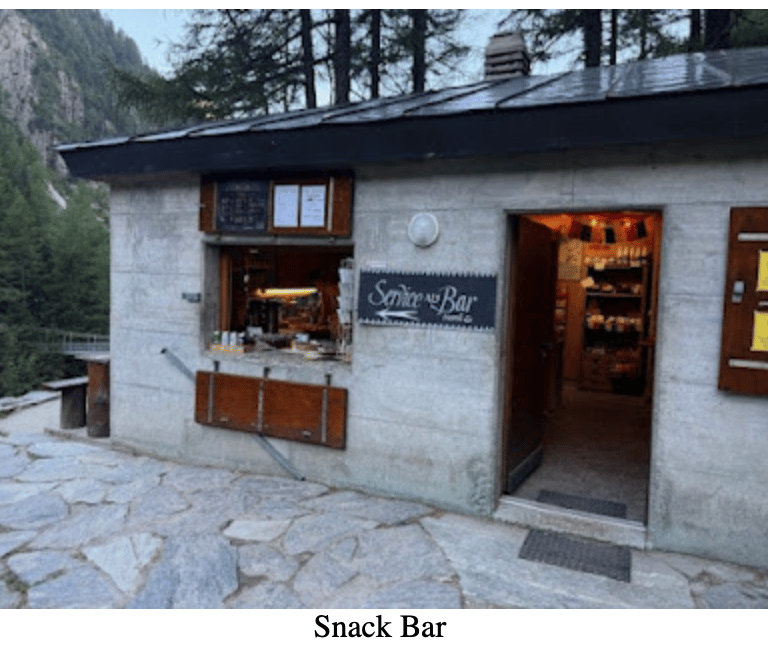
After about 3 miles of uneventful hiking, I arrived at a little food shack at the base of the mountain I was about to climb. I love seeing places like this. There’s no practical reason to put a little food shack here. It’s only used for a few months out of the year. This place had both character and charm. I love patronizing places like this. The women working there was so pleasant and I chatted with her for a few minutes. I ordered a coffee and ham sandwich. When it was ready, I sat at the outside table contently sipping on the coffee and eating the sandwich. I needed as much fuel as I could get. The next 3 hours were what I would refer to as an enjoyable grind. The path was mostly empty for much of the day. Every 30 minutes I would look down to the valley from where I came. Each time amazed at what humans can do with their feet. Soon the valley was a distant blur.
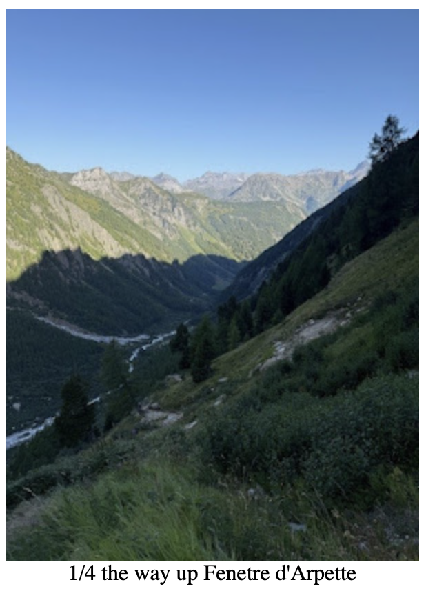
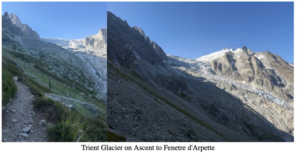
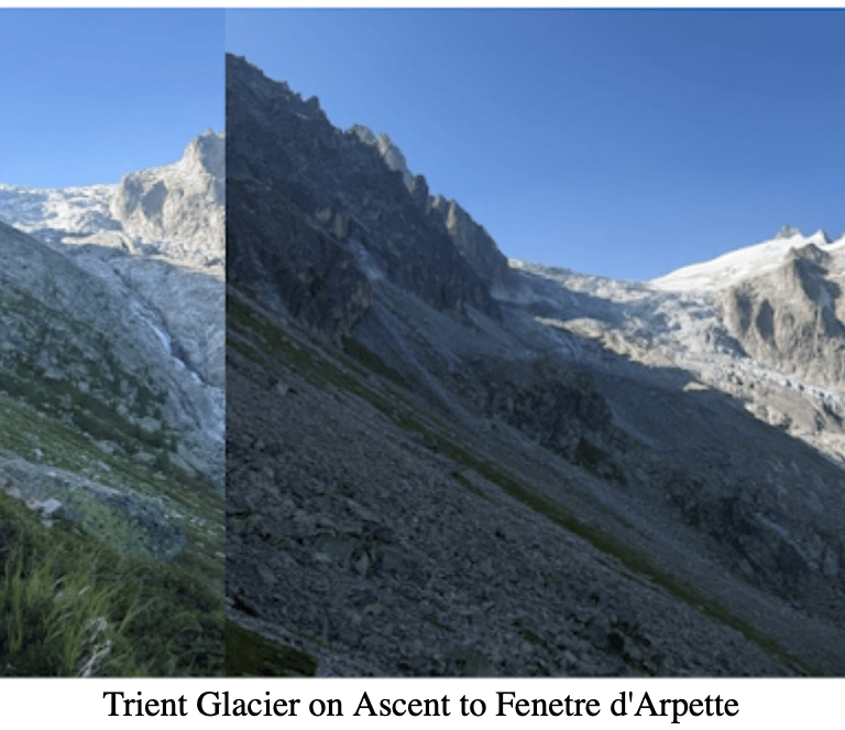
The river that I walked next to just a couple of hours before was now a thin line of indistinguishable color cutting through the valley below and out of sight (above pic). The tree lined path gradually gave way to rocky switch backs. The path continued up towards the pass with reckless abandonment. Small rocks gave way to boulders. The terrain became more technical. I could make out the pass in the distance.
Directly East of the pass was the Trient Glacier (above pics), an impossibly jagged mountain lined with ice and snow of varying shades of grey. It looked so out of place. Maybe it was me that was out of place. The scene was surreal.
When I reached the top of the Fenetre d'Arpette Pass, I felt equal measures of elation and exhaustion. It was a 4,000 ft ascent to get here. As far as ascents go, it’s hard to find ones that are much harder than that. I celebrated the accomplishment with a deep exhale. This was the 3rd of 13 passes I would navigate on this journey. I still had a long way to go, but I couldn’t help but think that this adventure was going by way too fast. Each pass I conquered was one less to look forward to. I tried to purge this asinine thought from my brain. Perception was at war with reality. I couldn’t let perception win. The reality was that I was only on stage 2 and still had a long way to go to complete it. I had to constantly remind myself to stay in the moment on this trip. At this moment I stood atop the mountain pass and looked down at the other side. A long descent down to Champex Lac awaited me. I took a few minutes to catch my breath, but I knew that time was not on my side today, so I took a long gulp of water and readied my pack. What goes up must go down, so I began the long decent down into the new unknown.
The hike down was hot. It probably wasn’t a good sign that my legs felt like jelly one hour into the descent, but all I could think about was getting to the lake. I needed to cool off and rest a bit before tackling the long afternoon hike to Le Chable. To make matters worse, one of my trekking poles snapped in half. There was no salvaging it and I was faced with the possibility of hiking another week without a trekking pole. Didn't seem feasible to me. It was a problem I would have to deal with later. As an aside, people often ask me if trekking poles are necessary. While it's a personal preference, I will say that roughly 90% of the people I see hiking on these multi-day routes have trekking poles. For me, they are a necessity, especially if you are tackling long distances with big ascents and descents.
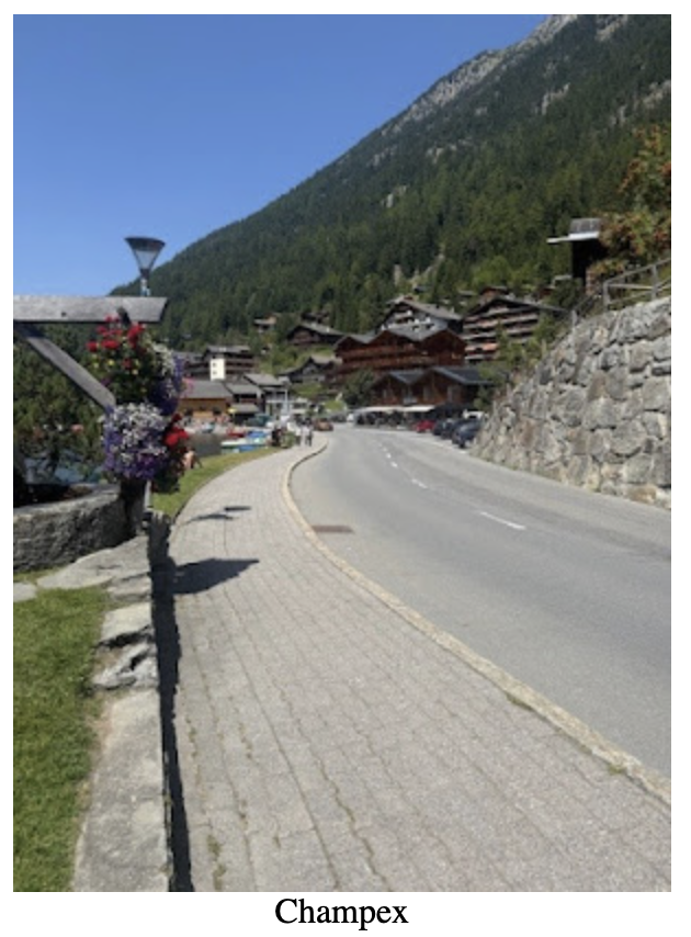
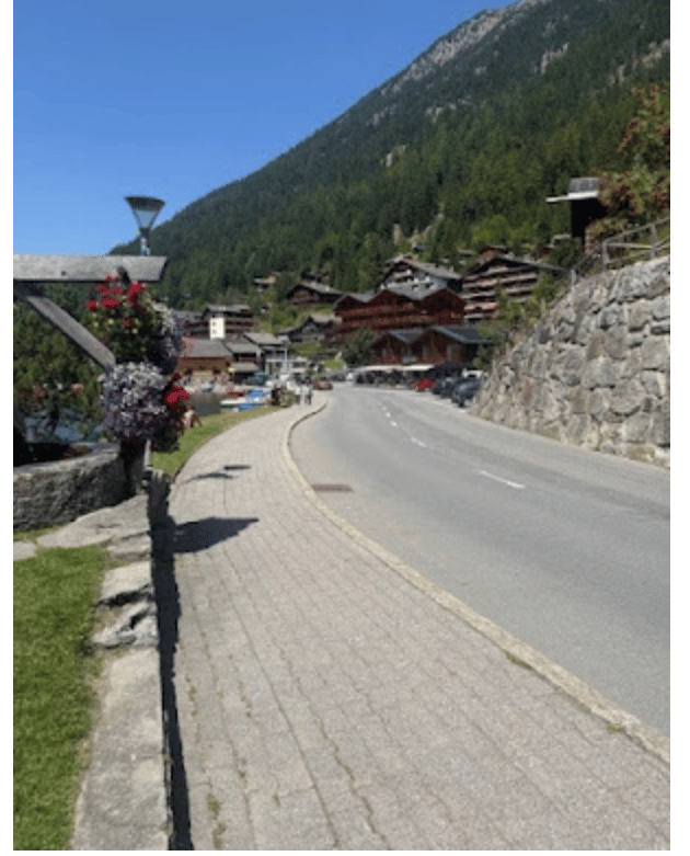
When I reached the quaint village of Champex I spotted a bakery. I learned early on this trip that grocery stores and bakeries were essential. They were the only two places you could get food at a decent price. I was starving and ordered a slice of quiche (I think it was quiche), a ham and cheese sandwich, a banana and a loaf of bread. I also bought a peach iced tea. The iced tea was so good I built up a strong desire to have one every chance I could. Perhaps it was the fact that it was cold? I don’t know. I laid my towel by the lake and ate my food. Eating felt mechanical, like I was filling up a car with gas. I didn’t savor it; it was simply fuel for the afternoon.
After I was fueled up, I jumped in the lake. It was heaven. All the sweat and grime washed off of me. My core temperature now in control, I was ready for the long hot afternoon hike. I made a mental note to look into Champex Lac at a later time. The village was stunning. It seemed like the kind of place you read about in those destination magazines. Hundreds of hikers milled about in the village. Some resting by the lakes, others shopping and eating at cafes. It was a true mountain paradise.
Refreshed from my dip in the lake, I continued on eager for the next stage of my journey. It didn’t take long for the heat to overcome me once again. There wasn’t much shade and the hike seemed to go on and on.
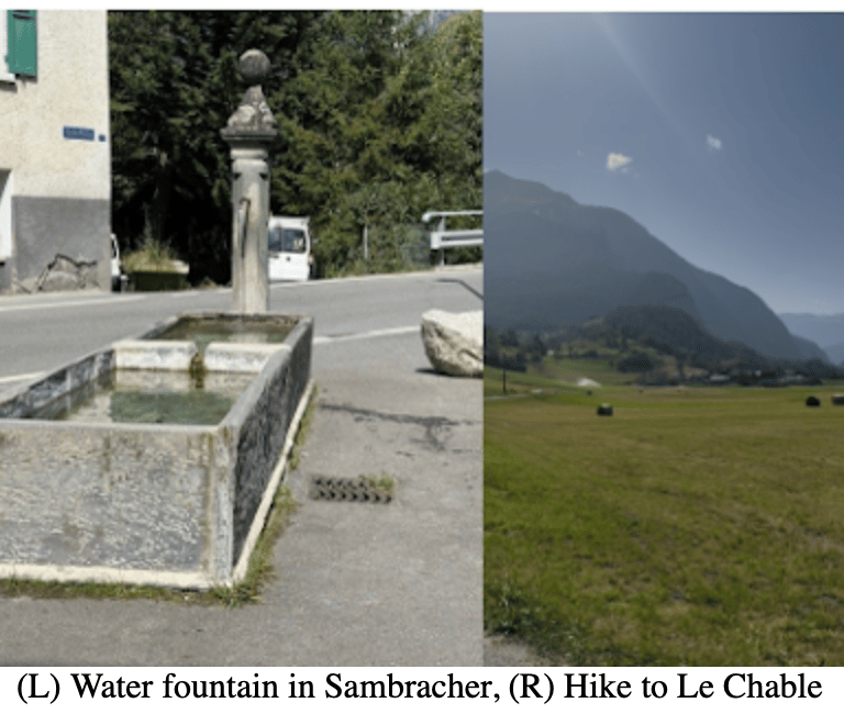
The trail followed a high grassy ridge. I could see the village of Sambracher far up ahead in the distance (above right pic). I knew that Le Chable was about 4 miles past that. I fell into survival mode hiking. One step in front of the other. I was drinking so much water because of the heat, but it didn’t seem to be enough. Thirsty and tired, I trucked on. Getting to my destination turned into a relentless pursuit of mind over matter. Time seemed to blend together in a foggy haze. The sun was relentless and unapologetic. Time management and pacing myself became insignificant. Instead, my thoughts shifted to essential needs. When is the next area of shade? How much water do I have left? Is that a blister forming on my right toe? These thoughts ran through my brain like a deck of cards being shuffled before the next hand. Should I eat? Should I rest? Where are the clouds? Eventually I made it to Sambracher. The temperature was 89 degrees. Too hot for the mountains. Too hot for hiking.
I found a village water fountain and made camp for a 5 min break. I refilled my water, dunked my hat in the fountain and put it on my head. Air conditioning. The cold water resurrected me for a brief moment. Enough to get my bearings. 4 miles left. The last stretch of hiking to La Chable was hell. The sun seemed to get hotter. I couldn’t escape it. Wide open fields of green and the sun hovering above, glaring and overpowering. It created a haze which made me feel like I was hiking in a dream state. Four miles turned to three. Three to two and then I had one mile to go.
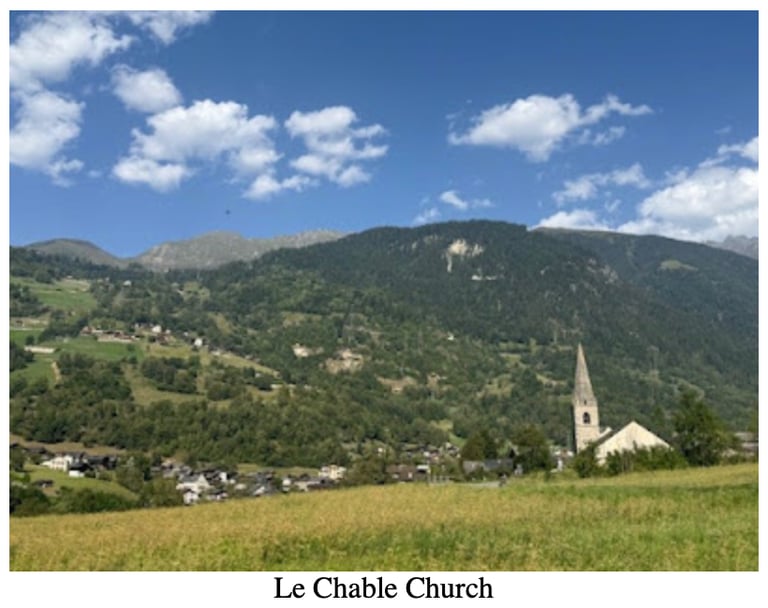
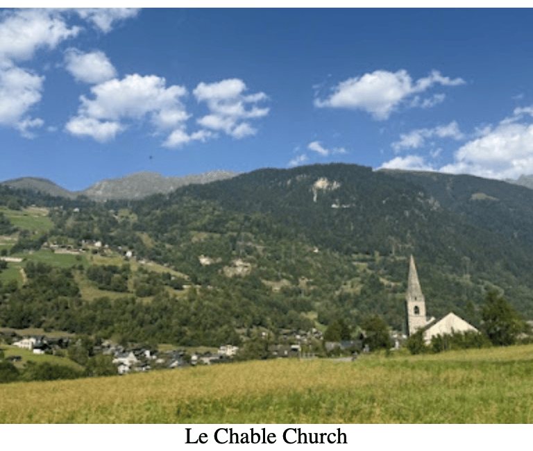
I remember spotting the La Chable church steeple on the outskirts of the village and relief washed over me. I made it. When I arrived at my hotel I was in the shower before the door to my room shut. There is no way to describe how good a cold shower feels after 10 hours and 30 minutes of hiking in 80-degree weather. The final tally was 19.23 miles, 4,548 ft of ascent, and 6,852 ft of descent. Like I said, Stage 2 was a bear. All I wanted to do was to lay down on my bed and close my eyes, but I had to wash clothes so I could hang them up with enough time to dry. After that tedious chore was complete, I sought out dinner. I found a lively restaurant right next door to my hotel, and I ordered a chicken sandwich and a salad. For some reason I was craving greens. I took the food to go, went back to my room and ate it. After dinner the world of dreams beckoned me. It wasn’t that difficult to find. Even jet lag couldn’t defeat exhaustion. I drifted for a few minutes before falling into a deep, restful and much needed sleep.
Stage 3: Le Chable to Cabane Mont Fort
Thankfully, stage 3 is probably the easiest stage of my itinerary. It wasn’t too much of a stretch to call it a rest day. It was a welcome break after the 19-mile 89-degree Stage 2. I took my merry ole time in the AM, which was an absolute luxury. I had coffee and breakfast and reviewed my plan for the day. The first part of my day was a hike up to Verbier which I would describe as an adventure hotspot. In the winter Verbier is the kind of ski village you dream about. Modern amenities, plenty of bars and restaurants and lots of shops. In the summer it was a mountain bike mecca. As I hiked up to the village, I could see hundreds of people on mountain bikes following the plentiful mountain bike trails that weaved in and out of the mountainside.
The infrastructure of this place was perfect for the sport. Large gondolas were equipped to carry mountain bikers (and their bikes) up in volume. I immediately sent a text to my buddy who is a big mountain bike enthusiast. The text was simple: “Google Verbier mountain biking. You won’t be disappointed.”
I wandered around town and stopped in at a sporting goods store to replace my broken trekking poles. Surprised to find a relatively inexpensive option, I purchased the poles and went to a coffee shop for a coffee. The coffee was so good I took a picture of it (Above right pic). From Verbier there is an option to take a Gondola up to the stop station. It saves a couple hours should you not want to deal with the boring switch back trail that climbs directly under the cable car. I definitely recommend the gondola as you won’t miss much, and you will save your legs. I took the trail.
Once at the top station, I had about a 3 mile walk to Cabane Mont Fort, my destination hut for the night. Again, I took my time. I stopped at mountainside café to have a snack and watch the dozens of the paragliders carry their paragliding packs from the Gondola down to the launching area. One after another, they laid out their paragliding gear, put on their helmet and took off into the sky (above pic). It was quite a spectacle. I couldn’t help but think about how unnecessary a helmet was for this activity. Either way, I had zero interest in trying it. Or perhaps the better way of describing how I felt about it is to say I have zero interest in dying by falling from the sky and crashing into a mountain. Helmet or no helmet, I was out.
I thoroughly enjoyed my walk up to Cabane Mont Fort. It was peaceful and I took my time while taking in the scenery. Cabane Mont Fort sat perched on top of a ridge overlooking the endless green landscape. There was a sitting area on the back side of the hut and people were eating and drinking.
For lunch I tried Rosti, which is considered the quintessential Swiss specialty food. I give it a solid B-. It had lots of potatoes which was a plus, but way too much cheese. Picture a cauldron of melted cheese with a few potatoes floating about. Ya, way too much cheese. After lunch I inquired about checking in. I had a couple of hours to burn so I left my pack at the hut and went for a stroll in the area. I found a flat rock to lie down on while I admired the scenery. This was a truly magical place. I was thankful that I was able to experience this adventure. I felt privileged and lucky to be there. A wave of contentment washed over me. Contentment is an underrated feeling. It’s a feeling that can be elusive during the grind of day-to-day life. I let it soak into my skin, into my being. I was there for about an hour, but it felt like 5 minutes. I wondered back to the hut, high on satisfaction.
I met a Dutch couple and chatted for a while. They were hiking the WHR, but they were camping. I was intrigued by this and asked a lot of questions. The idea of hiking outside sounded pretty amazing. The issue was that there were all kinds of rules on where you can camp and where you can’t. Intriguing as it was, I liked the hut experience. Speaking of which, it was time to check into my room. While checking in I met the most obnoxious American solo hiker I have ever had the (dis)pleasure of meeting. I can’t remember his name, or maybe I’ve already repressed it, but he was from Utah. Utah was a classic one upper. He was well travelled, and he wanted everyone to know. I do find people’s travels interesting, so I asked a lot of questions. He would occasionally ask where I had hiked and when I answered he would quickly demean the place or demean the accomplishment. “Oh, I didn’t like Italy. It was too easy.” “What? You haven’t been to Norway? That’s crazy.” Before dinner he cornered me on the porch and told me his life story. I nodded my head and darted my eyes around looking for an escape route. After about 1 hour he got a phone call. I engaged in a silent celebration in my head, and I used his phone call as an opportunity to escape. Finally free from Utah, I went to my room and began the tedious process of organizing my pack.
Come to find out I was in a room of two. WOOHOO!!! That was a luxury. Unfortunately, I was in the room with Utah. UGGGGGG! That was a travesty. At dinner I met an older woman from Denmark. She attempted the WHR 3 times and got injured every time. I was inspired by her determination to complete it. Unfortunately for her, she was once again injured, and she was going home tomorrow. It was a sober reminder of just how difficult this hike was. I met many people that either quit or bypassed sections due to health issues.
The first course was served; some kind of squash soup. I talked with two Swiss friends that had hiked here for one night and were headed home in the AM. They were pleasant company. Unfortunately, Utah was also at the table, and he proceeded to tell his life story (the same one he told me) to them. It was nice to see that he was one upping everyone at the table and demeaning their accomplishments too! I guess it wasn’t just me. I can’t get too mad at this as 99% the people I meet on these adventures are amazing. Utah was the rare dud. The second course was a polenta dish. Creamy and filling. Desert was ice cream and some sort of French toast type treat. I ate both without a second thought. I ate every morsel of food on this trek. Not once did I feel full.
After dinner everyone stayed up to watch the sunset from the outdoor porch area. People were talking about tomorrow’s hike and what I heard only validated what I had read. Tomorrow was considered one of the best, if not the best stage of the WHR. I went to bed eager to find out if that was true. No surprise to me, Utah was a snorer. I put my headphones in and tried my best to drown out the sound. I do have to say that I enjoyed listening to him snore more than I enjoyed listening to him talk. Small victories.
Stage 4: Cabane Mont Fort to Hotel du Barrage
The Grand Dessert Junction. It is, from all accounts, the highlight of stage 4. Some say the highlight of the entire WHR. It is touted as a truly magical place. Isolated. Raw. Unspoiled. Immensely beautiful. I was so eager to start the day, I forgot the packed lunch that the hut put together for me. I started early, around 6:15 AM. I didn’t get much sleep but I didn’t much care. I couldn’t wait to tackle 4 passes today. Yes, you heard me, FOUR passes. I’ll spare you the drama and tell you upfront that Stage 4 didn’t disappoint. It is on the short list of best hiking days of my life.
The first pass, Col de Chaux, could be seen from the hut (above pic). There was a hiking group starting their day at the same time. A group of about 6 with a guide. I said good morning to them as I skipped ahead at a pace that was way too fast. I was headed into the Grand Desert Plateau and there was no slowing me down. I didn’t know what that meant exactly, but I certainly wanted to find out.
It took me about two hours to get to the Chaux Pass (9645 FT). The other side of the pass might has well have been another planet. It is what I would imagine the moon would look like. Rocky. Grey. Desolate. My eyes shifted up and scanned the horizon. The contrast was jarring. Different shades of green overlayed with white jagged mountain peaks painted the sky. I spotted a mountain lake that looked like it was 100 miles away. It complimented the scene in a way that was both subtle and overt. My heart rate increased. Time seemed to speed up. I was intrigued. It was as if my subconscious was prepping me for what was to come.
The sun blinded me as I scouted the next section of hiking that headed straight down to a rocky plateau. This short steep section down was treacherous. A waterfall of scree lined the trail like sand lined a beach. Each step had to be precise, otherwise I was at risk of letting the scree grab me and sweep me away to unforeseen dangers. It was too early in the morning for this. When I made it down to the plateau, I let out a sigh of relief and looked back up to the pass.
I saw the first hiker from the group I passed this morning standing on the ridge (above pic). Now a tiny speck, so inconsequential in the landscape, it was almost laughable. Yes, that was a steep stretch indeed. I turned and started walking down the path eager for the next surprise. It didn’t take long.
A small glacier lake appeared out of nowhere and I stared at it as if in a trance. Was this place real? Was it a mirage? The color. How do you describe that color? It was like no other lake I have ever seen. Little did I know that I would see a half dozen (or maybe more) of these mountain lakes on today’s hike. Each lake unique in its own way. Each more beautiful than the previous.
The next pass was Col de Louvie, which sat at 9583 FT. I don’t know how long it took me to get there. Time didn’t time here. Its flow was unpredictable, unreliable, and unprecise. I tried to stay in the moment as best I could because I knew this was going to be a day that zipped by in a blur of wonder. I passed a French hiker at the top of the Pass. He was coming from the other direction. I said hello and continued on.
There was a section about 50 yards in which the path went directly through snow. This is the first and only time on this hike I would encounter snow on the trail. Sure, I would see patches everyday, but today the path went right through it. The feeling on my feet was odd. The whole experience fit this place perfectly. The hike headed down to another plateau. On my way down, I saw two Ibex.
One was sitting on a rock staring at me. These animals are majestic. Their horns curved giving them mystique and character. I am not going to lie to you. I was a bit scared. I’ve never read of a mountain goat attacking a human, but I tried to give it a wide berth just in case. I kept my eyes locked on his (or hers) until I passed. When I finally turned my head, boom, there was another one. This one was lying down. It was about 20 yards from me. Smaller than the first and yet somehow just as intimidating. I slowly walked by while asking myself for the 50th time if this place was real. It’s these moments that stick with you on these treks. I had this place to myself. Just me, the Grand Desert Junction and the ibex. The ibex behind me, I continued on ready for the next surprise. The trail twisted and turned. It rose and fell. I was hypnotized by the rhythm of it. It didn’t have a pattern, but yet it did. I was jolted out of my trance when I crested a hill and entered a new section of this stage.
There it was, yet another lake (or was it two?) situated on the boundless plateau as if it was placed delicately by gods own hand. This one was enormous. Glacial for sure. I could trace the source of the water to high up in the jagged peaks to east where huge swatches of snow and ice were melting at an impossible rate. I spent some time at this lake(s) trying to capture the beauty of the place (above middle pic). My camera couldn’t do it justice, but it didn’t matter. I will never forget that plateau and I will never forget that lake. I had to navigate across the thousands of little tributaries to get back on the path. From there, the trail headed up to the next pass, Col de Prafleuri. This was the highest pass on the WHR sitting at 9850 FT. I followed the path up for what seemed like hours, but I didn’t care. I didn’t want the day to end.
A group of 4 French hikers were headed my way from the other direction. They stopped and asked me something in French. “No Frances, do you speak English?” I asked. They did. One of the hikers, a middle-aged women lifted up her foot to show me her hiking shoe. The sole was hanging off. The shoe was finished. A few more steps and the entire bottom of the shoe would come clean off. This was not a good place for a shoe malfunction. They asked me if I had any duck tape and boy were they shocked when I said yes. I took out my medical kit where I kept a little role of duct tape and said to the women, “I hope you like orange.” They were so happy and grateful. They used the entire role to wrap the shoe so it could make it through day. I always bring duck tape with me on when I hike. It’s a versatile tool and very useful for situations like this. I was happy to help because I believe in karma. Someday I will need help from a stranger and someday I will get it. That’s how karma works. At least I choose to think that’s how it works.
The experience lifted my spirits and before I knew it was at the top of the 3rd mountain pass of the day, Col de Prafleuri. The adrenaline was starting to wear off, and I was starting to get fatigued. I sat down and took in the view. Another absurd view laid out before me. This would NEVER get old. I was also starting to get hungry. I knew that I would pass Cabane Prafleuri on my way to the 4th and final pass of the day. I planned on having lunch there.
When I arrived at the Cabane (hut) I was famished. I ate a large piece of quiche and a ham and cheese sandwich. I sat at a picnic table with a group of other hikers and ate with absolute contentment. I had an ice-cold iced tea and when I finished it, I got another one. I filled up my water supply and started my ascent up to the Col de Roux. I will be honest and tell you that I didn’t have high hopes for this pass. How could the scenery get any better. I was now closer to civilization so I guess I just assumed it would be mediocre by comparison. Boy, was I wrong.
At the top of the Roux Pass (9199 FT) I took in a scene that I will never forget. There, on the other side of the pass was the most beautiful lake I have ever seen. Lac Dix was not the kind of lake you saw on postcards. It was the kind of lake you see on murals and in museums. I was in absolute awe. The color. The shape. The backdrop. Lac Dix was simply the most beautiful place I have ever seen. What else is there to say? There were a number of people on the pass. Like me, they were staring with their mouths open unable to comprehend the beauty of the scene. I have read many stories about people in near death situations being paralyzed with fear, unable to move, unable to breath. Here, instead of fear, people were paralyzed by awe. When you book a trip or plan an adventure, you always hope that what you experience will change who you are. That your experience will be transcendent. In my experience, those moments are hard to come by. This moment would not only live up to my hopes and dreams, but it would far surpass my expectations in ways I didn’t know were possible. As much as I wanted to stay here forever, it was time to go.
I looked at my map and realized that I would spend the next few hours walking down to the lake and then along its West shoreline all the way to my hotel. I didn’t care that I hit a level of exhaustion I haven’t experienced often in my life. I didn’t care that the heat had left me withered and caked in five layers of sweat. All I could think about was how lucky I was to be experiencing this place. Lac Dix was a large lake. For the next two hours I had to walk 3 miles to get to the Western side where the tallest gravity dam in the world, The Grande Dixence Dam (935 Ft), resided. On my trip I had heard from multiple people that this Dam was featured in the James Bond movie Golden Eye, however a quick google search has proven that not to be true. Oh well. From the Dam, I had a 40 min downhill hike to my hotel. Getting to the hotel was bittersweet. The day was over, but damn (pun intended) was that an epic day. I couldn’t wait to shower, eat and go to sleep. Stage 5 was no easy task, so best to get rest, refuel and be ready for tomorrow’s challenge.
Stage 5: Hotel du Barrage- Les Hauderes (Hotel des Hauderes)
I finally got a good night’s sleep. Thank God because the first 45 minutes of Stage 5 was up a switch back trail that ran adjacent to the Grande Dixence Dam. Just before reaching the top of my ascent, which is also the top of the dam, I spotted two chamois up on the hill. While chamois are not quite as exotic as an Ibex, they are still pretty damn (sorry) awesome.
They spotted me and jetted off in the opposite direction. The next 5 miles was a stroll along the west side of the Lac Dix but in the opposite direction of what I hiked yesterday. There are a couple of manmade tunnels on West side of the lake and walking through these in the early morning darkness was terrifying. There was one tunnel that was at least ¼ mile long.
The trail followed the lake in a mostly straight direction. After about an hour, I encountered group of grazing cows. Perhaps 2 dozen of these seemingly docile creatures were scattered to the left of the path, to the right of the path and to my misfortune, on the path. I have had these types of encounters with cows before and let’s just say, they aren’t big fans of me. Also, I wouldn’t classify them as docile. While they “pretend” to be docile, I’m pretty sure they all conspire to terrorize humans. I have seen people (hikers!) pet these animals, so maybe it’s not all humans. Maybe it’s just me. I had an experience in Italy with a particularly large group of cows on a cattle drive to which I still have nightmares about to this day, but that’s another story for another time. It’s a love/hate relationship because I have come to love the melodic sound of the cow bells. To me, it was just so distinctly “Alps.” Hearing the bells made me happy, but encountering cows directly on the trail did not.
I tried to move slowly and not get them riled up, but they are absolutely huge. The ones with the horns scare me the most. About 4 of the largest horned cows that exist on earth decided they would “graze” right on my trail. No problem, I climbed up the hillside and circumvented them. Did I risk turning an ankle or spraining a knee just to avoid these animals? Yes. Yes, I did, but it was worth it. I had to do this three times before reaching the far side of the lake.
As much as I enjoyed this section and this lake (except the cows), I was eager for something new. Thankfully the trail headed up and away from the lake. For the first time in the day, the blazing sun made its presence known. Prior to this section, I had been hiking in the shade. As I climbed up the steep grassy trail it felt as if the temperature doubled. It was a shock to my system. I couldn’t shut the sun off, so I continued on. I tried to settle into the discomfort. It would only get hotter from here. I continued on through the new landscape. I crossed over a raging river, which looked to be more glacier and snow runoff. It donned on me that this flow was headed towards Lac Dix. I was going away from the lake; the water was going towards it. This realization made me sad. Lac Dix was a hiking milestone for me. A Mount Rushmore hiking moment and it was time for me to leave it behind. I reframed my expectations. What if the next section was better than Lac Dix? What if Lac Dix was the appetizer and I had yet to taste the main course?
The anticipation started to build as I settled into my hiking rhythm. I felt like I was gliding along the path. The new scenery was my fuel. The promise of something new was my motivation. This area was quiet, remote. The only sound was the roar of the river that weaved its way through the scenery with reckless abandonment. I passed an older couple hiking in the same direction. 60 maybe? It’s hard to tell. It’s tough to pinpoint an age on hikers in the Alps. They are a different breed. They seemed to have found the secret to ageing slowly. No tricks. No drugs or plastic surgency. They simply hike in the Alps. Natures fountain of youth. Just fresh air, mountains and grueling terrain with plenty of breathless ascents and knee buckling descents. Speaking of ascents, the trail climbed to a high ridge that overlooked a valley filled with gray rock and glacier. To my left was a high rock wall that seemed to rise to the clouds. Across the valley there were more mountains stretched far, wide and across the horizon (below pic).
After a couple of hours, I spotted a hut sitting on a plateau across the valley (above pic). How can a hut be there? It was on the precipice of a cliff! I would later find out it was Cabane di des Dix. It looked like a place where no hut should be, which made me feel sad that I didn’t stay there. The ridge started to get narrower and the hike more technical.
After a while, the trail cut left and up towards today’s pass; Col de Riedmatten. To the right (above right pic) someone had gone through the trouble of writing “way closs” which I took to mean that it was closed. There was also a crude picture of a ladder with an “X” through it. A sick part of me was curious to validate the messages and head that way, but I’m not a moron (usually), so I stayed the course and followed the trail up towards the pass. This section of the trail had some aided ropes which was helpful because the terrain was steep and technical.
When I reached the top of the pass (9679 FT) I sat there and took in the scene. It was so remote and rugged. No glitz, no glamour. Just raw, unforgiving, unapologetic rocky terrain. I took a billion photos and then headed towards the other side of the pass. The descent the standard switchback style and I flew down as if I was late for a party. The trail meandered down the valley and across rocky grasslands.
After about 2 hours I reached the village of Arolla. Here I went to a local store and bought some supplies. It was hot out. Close to 80 degrees hot and I had a long way to go. I rested for a few minutes and met another American couple. This couple was from Alaska and was here to do some mountain biking. Americans seem to love Switzerland. I decided to keep hiking rather than stopping for lunch. The trail headed up and out of town and through a very wooded area. This section, which took about 1.5 hours was all PUDs. PUDs in the hiking community stands for “pointless up and downs.” It’s psychologically challenging to navigate these sections. Up down. Up down. Up down.
The heat was getting to me. The PUDS were getting to me and then out of nowhere the terrain opened up into a wide green plateau (above pics). A sign on a post stated, “Welcome to this little corner of paradise.” This was promising! I crested the hill and there it was, Lac Blu. It’s difficult to describe this place in words. I guess the signpost did the job for me. Paradise. Yes, paradise is fitting word to describe this place.
This “lake” was out of a fairy tale. Like the name indicated it was blue, but this wasn’t any ordinary blue. This was a blue I have never seen before. I couldn’t remove my eyes from the scene. I stayed here for 45 minutes taking pictures and enjoying the scenery. I could have stayed there for a week, but I had to keep going. I had a long way to go, and it was getting late in the day. The trail headed down a steep well-travelled (by tourists) trail to a small village of La Guille. La Guille was a tiny Italian inspired village that had two restaurants and a handful of houses. I decided to get some pasta and bank some energy for my hike tomorrow. I ate every bite and was on my way within 20 minutes of sitting down to eat. The next section was a long descending wide trail that ended in my destination village, Las Hauderes. As I walked down the path I encountered an odd sight. A small car was parked at a trail head. Two young men got out of their car and hung a rope across the entrance to the trail. A sign dangled from the rope. It was a picture of someone shoveling coal. It read to me as “trail is closed.” Maybe they needed to do some trail work? I don’t think they would be shoveling coal here. Hmmm. The two men got into their car and drove away. Odd. They never said anything to me; they simply drove by me and that was that. The thought of backtracking uphill to the road at La Guille and finding another way to Les Hauderes made me sick to my stomach. No way did I want to do that, so I simply ducked the rope and headed down the trail. Worst comes to worse I would plead ignorance.
After another hour I realized I made the right decision. There was nothing on the trail that would suggest it should be closed. In fact, a French man came down the road on a bike and stopped to chat with me. Unfortunately, I didn’t understand a single thing he said and he didn’t speak a lick of English. It didn’t stop him from chatting with me for about 5 minutes. I just shook my head and kept walking. He probably wanted to talk about the trail closure. Another hour and I was in Les Hauderes. It checked into my hotel which was conveniently located right next to a bakery. I checked my watch. It was close to 5PM. I knew the bakery would be closing soon so I hurried over. I bought 4 sandwiches, 3 pastries and 2 iced teas. I didn’t eat all of it. The plan was to eat a sandwich or two for dinner, another one for breakfast and carry the last one for my hike tomorrow. I also walked down to the local grocery store to pick up a few items. Once back at the hotel I took a shower, ate some food and went to bed. It was another great day on the WHR. I couldn’t wait to see what the next day would bring.
Stage 6: Les Hauderes (Hotel des Hauderes) – Cabane de Moiry
I opted to skip breakfast at the hotel so that I could get an early start. The first half of the day was a long ascent up to Col du Tsate. After stage 5 I couldn’t help but think that Stage 6 would be a bit of a letdown. I was wrong. I absolutely loved this stage.
The path steadily climbed into the mountainside and soon I was surrounded entirely by green. Rolling hills stretched far and wide. I felt like a pebble of sand on one of those large resort beaches you see on a postcard. Inconsequential. Insignificant. The path kept climbing and climbing but I didn’t care. Once again, I was in a hazy fog of contentment. This seemed to be a theme on this trek. Time passed and I didn’t even notice. I can’t explain what a luxury it is to be so caught up in the moment, so present, that time seizes to exist. People ask me why I go on these hikes. This is the answer. After about two hours (felt like 2 minutes), I spotted Col du Tsate, my destination mountain pass, high up in the distance. I couldn’t help but be slightly disappointed. I didn’t want this section to end. I took a break and ate a sandwich before my final ascent. When I reached the top, my disappointment was replaced by excitement as my eyes took in the scenery on the other side of the pass.
Another lake of impossible blue color. Wait, there were two lakes? Maybe three? No big deal, it was just another landscape that took my breath away. What I saw was only the beginning.
The next part of the day was filled with one impossibly beautiful scene after another. As I descended down the other side of the pass, the Moiry Glacier made its first appearance (above right pic). I knew that my destination hut, Cabane de Moiry, sat on a perch that overlooked the glacier, but that seemed impossible from where I stood.
From the Glacier, my eyes slowly tracked the horizon to the North where the blue glow of Lac Moiry captured my gaze and held it in a state of timeless stillness. It was just a sliver on the horizon, but its presence was amplified by its mystique (above right pic). Google told me that there are 144 shades of blue. Well, I believe it. Lac Moiry looked fake. I wondered if they put chemicals in the water to give it the smokey blue color. I stared and shook my head in disbelief. Where was I? Was it another mirage? First the Glacier; Stoic. Bold. Then the Lake; subtle. Ebullient. All of it was just so stunningly beautiful. I was truly in heaven.
The rest of the day was spent walking towards the glacier. It seemed like I was walking into it. I spotted the Moiry hut high up on a ridge in the distance (above right pic). How on earth could a hut be there? It was insanity. It took me a good three hours to get up to the hut.
The Moiry hut was the best Mountain hut I have ever seen or stayed at. It seemed to be newly renovated. It had a modern feel to it. One whole side of the hut was made up of glass panels that overlooked the Moiry Glacier (above middle pic). The backside of the hut overlooked the two oval shaped lakes and Moiry Lake in the distance. I savored the view like an Italian man savors a late-night espresso after a big meal. I took my time checking in and getting some food. I ate protein cake. It was dense and filling. I talked with a Dutch couple that I passed at Tsate Pass. We talked for a few minutes about how amazing this hut was.
I took a shower and organized my pack. I then went outside to take some pictures and wait for dinner. Dinner was served family style. It started with squash soup. The main course was ham, potatoes and various vegetables. Desert was some sort of custard. I ate everything that was put in front of me. At my table were two older Swiss couples that had hiked here for one night before heading back home in the morning. Across from me was another solo hiker that was doing the WHR. She was British and she was sick. She had been forced to take taxis for the last few days due to her health. We chatted a bit about this hut. She had been here 10 years prior and she informed me that the glacier had diminished significantly since that time. It made me sad that someday, it may wither down to nothing. If it did, this place will lose some of its magic. Tomorrow was going to be a very difficult day. Another 17+ mile affair, this time with 6004 FT of elevation gain and 6014 FT of elevation loss. My knees hurt just thinking about it. According to my guide, this was to be the most difficult day of the trip. It was listed as a 11+ hour day. I wanted to get an early start and thankfully this hut served breakfast as early as 4AM. This was because many folks were needed to get an early start due to their itineraries. There were a lot of rock climbers staying at the hut. I went to bed early excited to see what stage 7 had in store for me.
Stage 7: Cabane de Moiry to Gruben (Hotel Schwarzhorn)
Another day, another amazing stage filled with incredible views and challenging terrain. I got an early start. I ate a quick breakfast and headed out in the twilight of dawn. I used my headlamp for the first time on the trip as I navigated the path back down to two lakes I was at yesterday. I made quick work of the steep switchback trail and once at the bottom I settled into a nice pace as the trail headed toward Lac Moiry.
The trail climbed to a high ridge on the East side of the lake and followed the full length of the lake before heading up. The next few hours flew by as I had a permanent view of the stunning Moiry Lake as I walked.
I encountered two more Ibex on the path. They were disinterested in me, and they simply lay on some rocks overlooking the lake and stared at me. These animals were part of the landscape. They fit in like a clown at the circus. I was in their territory, and they paid little attention to me.
At the far edge of the lake, the path headed up towards the clouds. Dozens of cows grazed in the impossibly vast green hills. The trail became very steep as the sun was starting to make its presence known. The next hour was a switch back trail that climbed the mountain side with subtle severity. Before I knew it, I was breathing heavily and taking mini breaks to get my heart rate under control. Behind me, Lac Moiry painted the landscape. Now, in the distance and much smaller, it looked even more fake than it did before. Up and up, I climbed.
Cows, now little dots, lined the hillside, an interesting contrast against the backdrop of the lake and surrounding mountains (above pic). Soon, I would crest a mountain (not officially a mountain pass) and I would say goodbye to Moiry Lake for good. While it was sad to say goodbye to what was an amazing section of the trail, I took solace in the fact that I was once again headed into new territory.
The anticipation built as I summited the mountain and looked over to the other side. I had entered a ski mountain section of the trail. These sections were not typically my favorite, but it was a beautiful day and not a cloud in the sky. Chairlifts dominated the horizon. I took a seat on a bench at the top of the mountain (above pic) and ate a sandwich. A meal with a view. The next few hours were a long descent down to the popular ski village of Zinal.
When I got to Zinal, I found the local bakery and bought a couple sandwiches. I filled my water bottles at a water fountain and walked through town to the next section of hiking which was another huge ascent culminating in the Forcletta Pass (9514 FT).
It was now afternoon, and the constant uphill terrain was starting to get to me. Eventually I made it up to a tiny mountain village called Le Chiesso. I say it’s a village because I don’t know what else to call it. What’s smaller than a village? Google refers to it as a mountain pasture. It was just a smattering of a few buildings. No people were in sight. The trail continued to weave up and through green hills littered with cows. The panoramic views were stunning which helped to make the time pass on this huge uphill section. I thoroughly enjoyed the hike and I soaked up the scenery as much as I could. The last section up to the pass was a rocky switchback that didn’t look that hard, but my legs thought differently.
At the top of the Forcletta Pass I met an older English couple that I would meet again on stage 9 of my hike. I said hello and goodbye and headed down the path towards Gruben. An hour in and I was out of gas. Zombie mode took on a new meeting as I meandered my way down to another village, across a road and back into the woods.
I passed a farm that had more sheep than I have ever seen in one place (above pic). I’m guessing there were about 200 or so sheep grazing on a steep hillside. As I descended down the wooded trail, some dark clouds rolled in, and it started to drizzle. This was the first rain I had encountered since being in Europe. I welcomed it as it cut the heat and provided a momentary respite from the sun.
Unfortunately, the rain made the trail, which was strewn with tree stumps and rocks, very slippery and caution was needed to navigate safely. That is a huge task at the end of a very long day when my legs were getting more and more numb by the second.
It was a grueling hour before I reached the quaint village of Gruben. I found my hotel and checked in. I took a shower and spent the next few hours before dinner relaxing in the outdoor seating area.
Aside from sitting next to a creepy older English solo hiker who stared into my soul when he spoke, the hotel was great. I stayed in a room with 13 guys where all the beds where lined up right next to each other on the floor. Luckily, I was able to get the bed (above left pic) by the window! Despite the sleeping conditions I had my best night of sleep of the trip.
Stage 8: Gruben (Hotel Schwarzhorn) to St. Niklaus (Hotel La Reserve)
I woke up refreshed and ready to see what stage 8 had to offer. Today, I would be tackling the Augstbordpass (9,495 FT), which is the unofficial border between the French speaking part of Switzerland and the German. There is also an Italian speaking part, but the trail doesn’t venture through that part. After breakfast I followed the trail as it lifted up and out of Gruben.
After an hour the village of Gruben was a distant memory as the trail continued to gain altitude quickly. After what seemed like another 2 hours, the steep incline subsided and gave way to a new, less intense, section.
For the next couple of hours, I followed a high balcony trail that traversed along a high ridge overlooking the valley. It was hot and there was no shade. I passed a couple of German hikers, and we shared our feelings about the heat and lack of shade. Occasionally I would pass a tiny desert like tree that offered a couple feet of shade. Usually there was a person sitting under it. There may have been 3 or 4 of these trees along the way and each time the shade was claimed by an overheated hiker. I powered on determined to get to the top of the Augstbordpass because I knew once I made it to the top, the hardest part of the day would be over. The long traverse was done. The trail headed up. The surroundings were peaceful and uninhabited. I once again transitioned into survival hiking mode. One foot in front of the other. Repeat. These are the parts of a long-distance hike that are the most challenging from a mental standpoint. It can be psychologically crumbling if you don’t have the right mindset. Luckily, I did.
I passed through a high grassland plateau with a stream trickling right through the middle of it. I spotted a tent that was positioned right next to the steam. It was a postcard come to life. People were up and about tending to breakfast and washing clothes in the stream (above left pic). A pang of jealousy hit me. What an amazing place to camp. What a pleasure it must have been to sleep in such a pristine and peaceful area. I gave them a wave as I passed by. The trail eased its way up and out of the plateau and towards what was clearly my destination mountain pass. I continued on with a feeling of contentment that I only ever experience in the mountains. This place just kept giving and giving. I was more than happy to take all of it in and relish it with equal parts admiration and appreciation.
When I finally made it to the top of the Pass, a huge weight was lifted. The rest of the day would be spent descending down to St Niklaus. The next section was a big surprise as the trail bent to the South and the “Mattertal Valley” spread out before me. It was a long narrow valley strewn about with villages as far as the eye could see. I knew that to the far North of the valley culminated in my ultimate destination, Zermatt. The Matterhorn. The end of the road. The end of my adventure. I still had 2 days to get there, but I still felt more than a hint of sadness. This was a sneaky amazing section of the WHR.
A high traverse followed the Mattertal Valley giving an unforgettable bird’s eye view that I wouldn’t soon forget. Rocky ledges provided scenic overlooks, which were great places to take pictures and better yet, rest. I ate lunch on one of these ledges and soaked up the scenery while eating a sandwich and an apple.
After lunch I continued to follow the traverse for another 30 minutes or so before it started to descend down to the small mountain settlement of Jungen. I call it a settlement because calling it a village would be a stretch. Jungen was tiny, but it had character. People milled about the area in what seemed like a perpetual state of relaxation. A calmness emanated from this place. I felt it as I walked through it. There is something about these alpine communities that just felt “right” to me. I made a mental note that I should probably try to retire in this type of environment. From there it was a steep descent down to St Niklaus, my destination for the day. A small, slow gondola was available for folks that didn’t want to deal with the steep descent. It was about 25 Euro for the ride. I arrived in St Niklaus in the midafternoon right as the temperature peaked. Sweat had become a real problem, but I didn’t care because I had made it to the village. Like other villages I have encountered on the WHR, St Niklaus was small. However, it was a bit more spread out then other villages I had been to.
I passed the train station, a small restaurant and a grocery store (which was oddly closed) as I sought out my destination hotel. When I arrived, I checked in and showered. The hotel was modern and to say that the shower was a luxury would be a wild understatement. Refreshed after a shower, I decided to grab a drink and sit outside on the patio. Rain drops started to fall for the second time on this adventure, but what made this occurrence odd was that the sun was still out! What an odd place. It didn’t really help to cut the heat, but I welcomed it anyway. I relaxed while waiting for dinner. I headed back to my room to manually launder some clothes for the last 2 stages of my hike. I ate a nice dinner and went to bed with the windows open. The fresh air filled the room as I drifted off to sleep.
Stage 9: St Niklaus (Hotel La Reserve) to Europahutte
From everything I had read and researched prior to going on this hike, this section of the WHR was supposedly underwhelming. I left St Niklaus walking down the road with lower than normal expectations. The first 4 miles is a just a walk down the road that connects St Niklaus to Herbriggen. I wouldn’t call it unenjoyable by any stretch, but it certainly wasn’t much to write home about.
When I got to Herbriggen, the trail, as it often does, heads straight up and out of the village and into the hillside. The trail weaves through wooded forest as it gains elevation quickly. Once out of the trees, the WHR provides yet another unique section of hiking that I can only describe as engrossing. The trail opens up and follows the valley South towards Zermatt.
A giant snow-capped mountain dominates the horizon. When I first saw the mountain known as the Dom, I did a double take. Some mountains blend in with the scenery as if part of a larger pattern. The Dom was different. It looked so out of place, I wasn’t really sure what I was looking at. A massive mountain that stretched to the sky, a giant triangle shaped peak coated with grays gave the mountain an auspicious vibe. I reminded me of a wise old man. It loomed over its peers with an air of sophistication. It was in charge, and everyone knew it. But what was it? Dom meant dome in English. Or Dome shaped. I guess that made sense. A name like Dom wasn’t grandiose enough to describe this mountain. It was raw. It was dominant.
Little did I know that this mountain would be the backdrop of my surroundings for the entire day. Each hour, I would get closer to this alien mountain. Each hour it would grow in size. As if that wasn’t enough (it was), the trail started to get interesting. Now on the section of the hike called the Europaweg Trail, the path climbed enormous rock faces and passed over raging rivers. Giant metal staircases and bridges aided the path in ways I have never seen before. One section that scaled up a cliff had a system of switch back metal staircases that must have been a half mile long. It was truly unique. All the research that told me that this section of the trail was uneventful was completely erroneous.
This section was incredible, memorable, enjoyable and unique. Up and up I climbed, not caring that the temperature was rising and the trail was getting steeper and steeper. For the next few hours I would hike up along a ridge that switched back and forth and across more rivers. My eyes followed the trail up and up and over another ridge. My destination hut was somewhere up there. The Europahutte was the quintessential mountain hut placed in a place a hut should not be. The only way to get supplies to it was by helicopter or to carry them up by hand.
The Dom was still DOM-inating the skyline, now even larger than before. What an amazing place. The trail leveled out and ran across a ridge overlooking the Mattertal Valley below. I was at about 7500 feet. I loved the idea that I would be staying in hut this high up in the mountains with this view. I didn’t want the day to end. The final section before the hut was a long traverse that provided amazing vantage points to see the DOM (above pics). I took a million pictures trying to delay the inevitable end of my day of hiking.
The trail bent to the left, and I saw the hut about 1/3 mile below me sitting on tree filled ridge. (above left pic) To the right I spotted the Charles Kuonen Suspension Bridge, which was (I knew from my research) the longest free standing suspension bridge in the world (above right pic). It definitely looked long! I would be crossing it tomorrow.
When I got to the hut, I was immediately impressed with it. Situated on a perch overlooking the valley and the Dom, it was quaint and inviting. The people running the hut were super nice. I checked into my room and took a shower. After that, I sat on the porch that overlooked the Dom and the valley and had a Radler. After an hour I had already bumped this hut up my all-time list. The second-best hut on this hike and maybe the 5th or 6th best hut I have ever stayed at in the Alps. I was so content and relaxed.
At dinner I sat with the older British couple that I had met two days prior at the top of the Augstbordpass. This couple fascinated me. They were English but lived in Australia. They were on holiday for 4 months! Apparently, the companies that they work for allowed them to go on a long leave. They chose to hike for 4 months. They started by hiking the Alta Via #1 & #2. Then they hiked the Slovenian Mountain Trail, which is 500 KM long! And now they are hiking the WHR. Boy was I jealous. They must have been in their early 60’s and this is what they chose to do with their time. I admired them and we spoke for 2 hours while eating dinner. Finding likeminded people on WHR was not difficult. Everyone was there because they were passionate about the mountains. Kindship and conversation came easy and I learned a lot from talking with this couple. My biggest take away was that I had to get to Slovenia. I went to bed, saddened by the fact that tomorrow was the last stage of the WHR.
Stage 10: Europahutte to Zermatt (Hotel Holiday)
Stage 10 was broken. Well, that is to say that a large section of the trail was closed. It had been closed for a long time after some weather damage from the previous year. This section of the Europaweg was supposedly exposed, remote and technically difficult. All adjectives that describe what I look for in a great trail. It was not meant to be.
The morning started with the crossing of the Charles Kuonen Suspension Bridge, which just so happens to be the longest suspension bridge in the world. Doesn’t that sound exciting? It was ¾ of a mile long. Doesn’t that sound long for a bridge? I didn’t know what to expect as I took my first steps onto the bridge. Luckily, there weren’t many hikers around, because this bridge was terrifying. As I took each step I tried to remind myself not to look down. At the midpoint of the bridge, I must have been 2000 FT above ground. Google says its 279 ft. Lies! The bridge swayed with each step. I couldn’t help but play out worst case scenarios in my head. I contemplated the idea of grabbing onto the cable railings should the metal grates at my feet break apart and give way. How long would I last dangling so high about the ground? After what seemed like an hour but was probably 15 minutes, I made it to the other side. I was glad I did it, but I was happy it was over. Because of the trail closure, the alternate route was to hike back down to the valley and catch a bus up to the village of Taschalp to bypass the closed section of the Europaweg. It took a couple of hours to get to the valley and another 30-40 minutes for the bus to take me up to the start of the next section.
Before getting down to the valley did spot a couple of chamoix in the woods. It’s always a win to spot either a chamoix or an Ibex, so I took it as a good omen for what was to come on my final day.
The town of Taschalp sat high up on a mountain plateau. A few houses lie scattered about. I saw a restaurant too. There was a simplistic beauty to this village. I was so eager for the next section, I didn’t spend much time milling about and headed up the trail. The path led me away from the village and along another high ridge traverse that seemed to lead into the horizon before taking a sharp turn to the South.
I turned the corner and there it was, the infamous Matterhorn. Now just a small triangle on the horizon, it called to me as if it knew that I was waiting to see it since landing in Europe. Once my eyes locked on it, it was difficult to peel them away. This made hiking challenging as I was having a hard time looking at the trail. I wonder how many people have stepped off the trail and tumbled down the mountain simply because they were captivated by the sight of the Matterhorn. My destination village, Zermatt, resided in the shadow of the Matterhorn, which meant that I would be spending the rest of my hike and my trip walking toward it.
That’s what I did. The high balcony trail set a course directly towards the village of Zermatt with the Matterhorn resting on it’s shoulder. I relished in the fact that I would be spending the next few hours staring at its beauty. The trail was essentially a long traverse with viewpoints throughout. As I walked, the Matterhorn grew in size.
One section had many “rock fall” warning signs and they even built bunkers in the mountainside along this section so that should a rock fall occur, hikers could seek shelter. Ingenious. There were some walkers on the trail, but it was not busy. I was surprised by this. It was a beautiful day and it was a beautiful place. I actually saw more bikers than I did walkers along this section. Biking along this section seemed like it was not a good idea, but sure enough people did it. One misplaced tire and….. well, you can use your own imagination. I would not be getting on a bike here. Nope. Every ½ mile or so there would be an amazing “view point”. Each time I reached one, I would stop and take pictures of Matterhorn and the surrounding landscape. As the Matterhorn grew in size, so did it’s mystique. It did not get old.
After a few hours I was able to make out Zermatt. A large grouping of buildings so nicely placed at what looked like the base of the mountain. Yes, this was going to be a magical place to end my adventure. When the trail started to head down towards Zermatt, a storm of emotions swirled around inside of me picking up speed and rushing to come out. My thoughts were battling each other in a chaos filled fight for dominance. “I did it!,” “I don’t want it to end!,” “I’m Exhausted!” “I wish there was more!” I didn’t know if I was happy or sad.
What I did know is that only a place like this, doing an activity like this, can elicit this type of emotion for me. I felt adrenaline and exhaustion at the same time. I felt alive. The long descent to Zermatt didn’t phase me. I knew I was going to make it. I knew that I had completed my goal.
Zermatt was every bit the fairytale mountain village that I had hoped for. At high tourism season, the place was alive. Crowds of people swarmed the area and filled up every square inch. I spotted the church, it’s steeple jetting up and blocking out a small section of the Matterhorn behind it. A river cut through the town splitting it into two distinct sections. I was immediately struck by the flowers. I have been to places where flowers were so stunning I didn’t believe they were real. Alaska was one such place. This was different. This place leveled up on the flowers game in ways I won’t soon forget. Many of the buildings had an absurd number of flowers on display. Some buildings were more flowers than building! It was an overwhelming sight. How do you make a Swiss Mountain Village that nestles under an iconic mountain even more beautiful? Flowers. Lots and lots of flowers. I checked into my hotel, took a long shower and walked around Zermatt trying to take in the scene. As each hour passed, I felt more and more exhausted. 10 days of vigorous hiking had taken a toll on my body (and my mind) and now that the hike was over, it wanted me to know that it needed rest. It did its job. It survived. After dinner I went back to the hotel to lie down.
When it was dark enough, I walked to a famous village viewpoint where I could capture a picture of Zermatt with the Matterhorn in the background. The scene played out before me. The lights of Zermatt illuminated the village somehow making even more mystical than in the light. My eyes tracked across the lit village then up to the luminous Matterhorn dominating the horizon. A grey cloud hovered at its peak giving it a mystical vibe. The contrast of the lit village with the ominous grey mountain made for quite the picture, but a picture doesn’t accurate depict what I saw with my eyes. That image will reside in my mind for a very long time. It is part of me now. Part of who I am. Part of my sole. The Matterhorn will forever be a symbol of my experience. Of my accomplishment. It will represent what was the end of an amazing journey. The Matterhorn will live in me forever.
I walked back to my hotel filled with the feeling contentment in my heart. This feeling of contentment was different than what I felt on the trail. This feeling carried the satisfaction of achievement. It was denser. More satiating. More than a year of planning, training and hard work went into the execution of this trek. I had earned this contentment and because of that it held a deeper more profound meaning to me. More importantly, it validated what I already knew about myself. I belong in the mountains. If that's a sickness, then I don't want the antidote. Alpine is my medication of choice. It's potent stuff. Addictive. Perhaps the dosage may change. So might the frequency for which I take it. Who knows, maybe one day I won't be able to refill the prescription. I doubt that will happen. I am an optimist after all. I have a feeling I will be doing this for a long, long time. For now, I will simply follow my instincts and let my passion guide me.
The mountains are calling and I must go.
-Mike Hikes 2025