The Slovene Mountain Trail - Year 1 - Maribor to Kamnik
Join me as I tackle the first 120 miles of the Slovene Mountain Trail solo.
HUT TO HUT
MikeHikesTheAlps
11/13/202652 min read


Slovenia is the only country in the world with the word “love” in their name and boy do they want you to know it. I realized this pretty quickly as I was travelling around the country. Their slogan is “I feel sLOVEnia” and everywhere you look, there is a 6-foot-high wooden shaped heart just waiting for the passerby to take a picture in front of it. If I had to guess, it’s a tourism marketing play used to create awareness about the beauty of the country. As far as marketing strategies go, I’ve seen worse. I found the “love” theme that was present throughout the country to be charming, and it fit the vibe of the country nicely.
The only issue with it was that there weren’t any tourists, at least not in the mountains and mountain villages I visited. I am sure that is not the case in Ljubljana, the capital of Slovenia. Known as the Green City, Ljubljana has built a strong reputation as the up and coming “go to” place to visit in Europe. It’s listed in all the travel magazines and online travel websites as a top 5 city to visit. It’s kind of like what Croatia used to be before it became overrun by tourism in the last 15 years.
While Ljubljana was a bustling pedestrian city with a recent uptick in tourism, the mountainous regions of Slovenia were still a secret. Don’t get me wrong, some of the more popular mountainous areas in Slovenia are quite busy. They just aren’t busy with tourists. From what I saw, the people hiking in these incredible mountains are mostly Slovenian’s. Sure you see a few Europeans . An Italian group here. A French couple there. I think I saw a few Dutch folks which isn’t a surprise as they are everywhere, but that’s about it. No Americans. Not in the mountains. At least not in the first 120 miles of the Slovene Mountain Trail. Many of the mountain huts have registers showing all the people that have stayed at the hut. I would rifle through these registers, sometimes going back years. No joke, it was 95% Slovenians. I think I saw one American from a few years back in a hut registry log. That’s it. As an American in Slovenia, I was a unicorn. I would say I stood out like sore thumb, but that wasn’t the case at all. People seemed to be indifferent to the fact that I was American. Maybe they didn’t even know. English was spoken regularly in Slovenia, even in the isolated mountain villages. Well, not everyone, but certainly everyone under 50 years old. Many of the restaurants I visited had menus with English translations. Good thing too because I found the language to be quite intimidating. It took me a few days to graduate from a “head nod” to “dober dan,” which means hello. Eventually I just started going with “dan” which is (as far as I can tell) “Hi”. After about a week I mastered the word hvala (“h” is silent) which means “Thank you.” You’d be surprised how easy it is to get by on “Hello” and “Thank you.”
I was curious about why so many people spoke English so I asked one of the hut workers. She was puzzled by my question and responded with “Everyone speaks English.” She didn’t go so far as to say “duh” but she might as well have. Her body language was such that I didn’t bother to ask that question again on this trip. Were the Slovene people rude? Hmmmm. I struggled with this question. At first I thought they were, but I came to realize that some things are lost in translation. After spending 10 days there, I now believe they aren’t. They are stern and to the point, which can come across as rude, but every time I had a question or a need, I was helped. In my current job I work with a lot of Albanian’s and it took me a while to learn that what I originally mistook as rudeness was really just a discomfort with the language. I figured the same to be true with the Slovenians.
After my trip I read up on why English was so prevalent in Slovenia, and I learned that it is taught at a really young age and is part of the typical school curriculum. That and the fact that Slovenia like many countries has become Americanized through social media trends, movies, music and pop culture.
In retrospect, the fact that I didn’t see a lot of tourists in the mountains makes sense. I should have guessed it because I found planning this trip to be near impossible. I would search the internet high and low looking for information about the Slovene Mountain Trail (known as the Polinska Pot to Slovenians) but information was tough to come by. I found some travel blogs and I bought the American Cicerone guide, but I am a very detailed and meticulous planner. I needed information and for this trip, I couldn’t find what I was looking for. It was equal parts frustrating and intriguing. I put in the time, I planned it out the best I could, but what I didn’t realize at the time was that the only way to truly learn about the Slovene Mountain Trail was to throw myself in the deep end and try not to drown. So…. That’s what I did. Here is my story.
Maribor
The Slovene Mountain Trail (SMT) starts in the college town of Maribor. The trail travels due West through the Pahorje Hills, then through the Kamnik-Savinja Alps before tackling the Karawanks and the crown jewel; The Julian Alps. The Trail then heads South and roughly follows the Italian boarder till it culminates at the Adriatic Sea in the town of Ankaran. The total distance of the trail is 384 miles. Like the Italian Dolomites and the much of the European Alps, Mountain Huts line the way and provide food and shelter for hikers looking to tackle the trail. My plan was to hike the first 120 miles of the trail.
I found Maribor to be like other towns I visited in Slovenia, just bigger. Maribor is the second largest City in Slovenia. It was clean, pretty and felt safe. I stayed in the outskirts of Maribor at a little guest house at the bottom of a ski mountain and awaited the start of my new adventure.
Section 1: The Pahorje Hills
Stage 1: Maribor to Ruska Koca (hut)
From the guest house, I had a two-mile walk to the start of the SMT. The trailhead features the first of many “stamp checkpoints.” One of the unique aspects of the SMT is that hikers attempting to complete the trail can acquire a stamp book that can track their progress throughout the hike. Over the course of the 384-mile hike, there are 80 stamp checkpoints which are typically located at certain mountain huts and on certain mountain peaks. Once the book is filled and the entire hike is completed, you can turn the book in for an official honorary “medal.” Everyone likes a medal. I know I do. I am a human after all.


I stamped my book at trailhead and began the uphill hike into the hills. After a few hours I reached the top of a ski mountain. It’s always a weird feeling to hike to the top of a mountain and see people getting off of a chairlift. I’m not sure if I felt a sense of satisfaction being the one that got the top by walking or If I felt stupid for not just jumping on the lift. Either way, it didn’t matter, I was at the top and that’s what mattered. I stopped at one of the busy restaurants for lemonade and a snack before continuing on the hike.
I knew going in that the Pahorje Hills section of the SMT was the least challenging of all the sections on this trail. In order to combat the lack of technical difficulty, I decided to combine stages to cover more distance and to really challenge myself.


I decided to take day 1 easy due to being an old man and not knowing what to fully expect with jet lag. The other big factor that plagued me on this hike was the weather. When I checked into the guest house prior to the start of the hike the 70-year-old women that owned the place let me know that this summer (2026) was the hottest and dryest summer she had ever experienced in her life. She was 70! Everyday was between 80-95 degrees and sunny. Yikes!! Despite taking it easy on the first day, I definitely felt fatigued when I stopped at the first hut of the SMT, Mariborska Koca. Here I got the second stamp of my hike and ordered an iced tea. It was so hot, the cold iced tea was truly heaven. I ordered another one. Most people stop here for day 1, but I wanted to cover more distance so after I stamped my book, I shouldered my bag and headed down the trail.


I arrived at my destination hut, Ruska Koca around 3 PM. Getting to a hut by 3PM was a luxury. I had plenty of time to rest relax and organize my stuff. I sat outside and had a beer. While waiting I got hungry, so I ordered some food. The outdoors area was bustling with day hikers and families. Here I tried the infamous “Union (pronounced onion by locals) 0% Shandy.” I heard about this from my taxi driver. He raved about it with so much pride, I made sure to order it on day 1. It was a lemon shandy. It was fine. It didn’t blow my mind, but it was refreshing. Everyone ordered this. As learned more about it, I learned that this was no ordinary beer. This beer had electrolytes and minerals. It was an ingenious invention. Hikers drank it because of this and the fact that it was thirst quenching. Don’t get me wrong, Slovenians are definitely drinkers. Plenty of folks were drinking real beer and other cocktails, but the hardcore hikers were drinking the shandy.


Although the hut was busy, not many people stayed overnight in this section of the SMT. There was a group of 5 Slovenians hiking the trail. I know this because they were collecting stamps and I would see them on day 2 and 3 before getting too far ahead of them. If I had to guess, I think the hut probably slept about 100 people. Only about 10 stayed there the night I was there. I had a room all to myself. I wasn’t complaining.
Stage 2: Ruska Koca to Hotel Rogla
After a hearty breakfast, I set out on the trail around 6:45AM. If Stage 1 was about easing into my hike, then stage 2 was about knocking out some miles. Going into the day it was difficult to determine just how long the hike would be. I estimated it at about 15 miles, but it ended up being longer because I took a few wrong turns. I wouldn’t say that the trail was hard to follow, but there seemed to be a lot of alternative route options, all of which displayed the famous SMT emblem marking it as officially part of the SMT. Simply put, it was hard to follow the main trail. Either that or I am just dumb. That is certainly a plausible explanation.


That being said, the hike was somewhat unmemorable. I walked down some roads, then through some woods and then down some more roads. I knew at some point I would have to get a stamp at Klopni peak, my first “peak” stamp, but other than that It was pretty much just rolling hills and hot sun.
Shade was my friend, so I preferred the wooded tree sections. I took a few wrong turns and added some mileage by backtracking and course correcting. It was frustrating, but I was in no rush. The hike was not in of itself challenging. It became challenging due to the fact that I was still jet lagged and was adding needless miles. When I got to the Klopni peak, I encountered a bunch of bikers and a few hikers. The peak was nothing special as it was below the tree line. This was also the first time I realized that Slovenia had an ant problem. I noticed it on some of the trails. There were times where the ground was more ants than ground! I would frequently pass anthills that seemed to be 5 feet tall and 2 feet wide. If I didn’t walk fast, the ants were so invasive and there were so many of them, that they would cover my shoes and get into my socks! This was even more the case on Klopni Peak. The stamp was located in a small wooden box that was attached to a tree. You wouldn’t know it was a box, because it was infested with ants. After actually contemplating skipping the stamp because I didn’t want to stick my hand into the ant infested box, I bared my teeth and grabbed the stamp as if I was trying to catch a fish with my barehand out of a river. I was lightning quick, but the ants still managed to get all over my hand.
Anyone watching me would have thought I was insane as I danced around and frantically tried to wipe all the ants off me. In the end, I won the battle. Not much to be proud of really, but a win is a win. My prize was the first stamp of the day.
I left the peak and headed down the trail. I was at about the 13-mile mark. I knew that I had a couple of miles to my next stamp at Koca na Pesku. This was the hut I was supposed to stay at for the night, but when I landed in Slovenia I got an email from the owner of the hut. He said that the hut was closed due to renovations and that they transferred my reservation to a hotel in Rogla, which was a ski mountain town about a mile or two up the road from the hut.
I got to the hut around 1PM and sure enough, it was under construction. I got my stamp at the mailbox and looked at my map. Rogla was 2 miles straight up a mountain. Great. Luckily there was a trail through the woods which was shady and cooler than the hot sun-soaked road option. I was tired and hungry. I continued up the trail at a slow pace. I was over 15 miles for the day, which is an aggressive distance to hike on day 2. When the trail plateaued out, I realized I was walking down a ski trail. Snow guns lined the trail, and I could make out a chairlift in the distance. This looked like a fancy ski town. I made my way into the ski village and found my hotel.


It was a nice place, and I was relieved to see that I had an amazing shower and a sink so I could wash my clothes. I also had an amazing view from my window! I took care of the washing, which I absolutely hate, and I took a shower. Getting this hotel for the price of a dorm bed felt like steeling, but I didn’t care. I was going to milk this luxury for all I could. I was hungry so I walked around the village and found a place to eat. I enjoyed a nice early dinner then headed back to my bed. I didn’t last long. I was tired and I needed to get a good night sleep. I went to bed with the window wide open letting the fresh mountain air fill my room.
Stage 3: Hotel Rogla to Slovenj Gradec
Stage 3 would end up being the longest single day of my trek. I knew this going in so I started early and made my way back down the hill I had come up just 14 hours earlier. The long descent was uneventful. I was tired from the day before, but it didn’t stop me from keeping a good pace.


After about an hour I reached a part of the trail that I will refer to as “the meadow.” This was a very beautiful section of trail that followed a high traverse overlooking a vast meadow with beautiful mountains in the distance. The trail cut through the high side of this meadow for a couple of miles before taking a sharp left to head down to a wooden landscape at lower elevation. While I walked I encountered a few day hikers as well as some women farming truffles. I made a mental note to read up on this as I thought it was fascinating the way they patiently went about the meticulous process of unearthing these delicacies.


While walking through a wooded area of the trail, I heard a strange grunt off to my left. Whatever the animal was, it was loud and active. Sure enough, I spotted movement out of the corner of my left eye. I got my camera out and videoed this animal darting back and forth and even caught it crossing the trail about 30 feet behind me. It was a small, pudgy animal. I would later learn it was a wild boar!


I followed the trail for another hour or two and eventually I came to a high plateau that provided me with stunning views of the surrounding area. I could see a hut up on the hill in the distance; Rabinska Koca. That was my next destination.


When I got there, I took a break, ordered some iced tea and got my book stamped. It was a beautiful hut. Modern. The staff was friendly and they were quite busy with day hikers. Here I saw the group of Slovenians that I had seen night 1. When I went to Rogla, they must have stayed in the valley. This would be the last time I would see them on this trip.
I left the hut and continued along the path. With each step the sun made its presence more and more known. Eventually I came to a wide path that headed on a slight downhill for what seemed like 100 miles.


A fence lined the path for as far as I could see. The scenery looked like something out of a movie. The word “stunning” doesn’t do this section justice. While walking I thought about how some big wig movie director should film a scene here. It would be an instant academy award nomination for cinematography.


The path eventually came out at another ski village. The area was bustling with people. Stages were lined up and it looked like there was going to be some live music performers. I took a break at a restaurant with a beautiful outdoor seating area. I ordered two ice teas and got my next stamp. It’s hard not to keep mentioning the weather. Oppressive heat has a way of making all other discomforts inconsequential. I looked at my map and realized pretty quickly that I had to climb straight up a ski mountain trail. Dread filled me. In this heat, it would be torture. What made it even more miserable was that I could see a chairlift going up the trail. There is nothing worse than climbing up a ski trail while watching people take the lift up only a couple hundred feet away from me. I could have taken the lift, but for some stupid reason, I considered it cheating. So, I climbed up the relentless hill in the brutal heat with the sun beating down on me the whole way. When I got to the top, I saw two 20-year-old guys getting off the chairlift. I looked at them, cursed them silently and kept walking.


I was on top of a ski mountain and the views were terrific. It was still quite hazy, so my pictures didn’t turn out the way I had hoped, but I enjoyed being on top of this beautiful mountain. The trail then descends into the valley and empties out onto a mountain road.
I could see the rocky dirt road bend around the corner before disappearing into the distance. Road walking is never fun, especially late in the day and especially when you can see 3 miles of road ahead of you. I started my walk in solitude. I didn’t see another person for the next hour. Thankfully the trail headed off the road and into the hills. Unfortunately, the hills were steep, demanding trails during the hottest part of the day. I was trying to get to the next hut that I knew was somewhere near the top of this trail. There I would eat some much-needed food. I was starving. While the hunger was bad, nothing was as bad as the heat. It was close to 90 degrees, and I had about 15 miles under my belt. I was struggling and the trail just continued to go up and up.
Like I have mentioned earlier, when I planned out this hike, I used the “Hikker” planning tool which I knew from reading online was not 100% accurate. That meant that on any given day I knew approximately how many miles I would have to hike, but it wasn’t always right. Sometimes there were less miles than it said. Today, it was more. The entire hike was supposed to be 18 miles long and I was fast approaching that mileage. I hadn’t even gotten to the hut yet. From the hut, I had a long downhill to the village of Slovenj Gradec. I knew the rest of the day was going to be tough.


I powered on and eventually made it to Koca pod Krmzarjevim. As soon as I arrived at this hut I plopped myself down at a picnic table and rested. This hut was on a plateau that overlooked the village of Slovenj Gradec. The signature giant wooden heart stood tall as if it was a window into the soul of the village below. I had just enough energy to muster a “wow,” which in retrospect didn’t do this place justice.


The owner of the hut didn’t speak much English, but we worked it out and he brought me some chicken dumpling soup. It was incredible. This old man was the nicest person I met in Slovenia to this point, and he didn’t speak any English. He was so gracious and kind. I stayed here for a while, eating, drinking water and relishing the views. I could see my destination in the distance. The village looked impossibly far away. I was at mile 18. The next few miles were going to be a true test. I kept thinking to myself that I had trained for this. I did multiple 20-mile hikes and even a 30-mile hike in the NH White Mountains. I also did a 40- mile hike as well. The 40 miler wasn’t in the mountains but somehow seemed to be more difficult than the mountain hikes. The point is I felt confident that my body could handle this. I just wish it was a little cooler out. Just a little.
I left the hut and headed down the steep, demanding trail. After a couple of hours I popped out on a street on the outskirts of the village. I looked at my GPS. I had 2 miles of road walking in the scorching 90-degree heat.
Slovenj Gradec was a beautiful mountain town. It was clean. Pretty. The houses were well made and well kept. I thought to myself, I could live here. Despite the heat, I enjoyed my long walk to my destination, which was an apartment on the far side of the village. I got there, checked in and took a cold shower. I knew instantly that this would be my best night of sleep. The AC worked well and the bed was comfy. It was quiet. I was happy.


After showering and organizing my stuff for Stage 4, I walked through town till I found a restaurant. I sat at the bar and ordered food and drinks. The food was a 9/10. The portion size was huge and it was incredibly affordable. What I ordered would likely cost 3X back home. I was content. I walked back to my room and took another shower. It was euphoric. I was in bed early. The final millage for the day was 22 miles. That’s a big day. I fell asleep instantly.
Stage 4: Slovenj Gradec to Dom na Urslji Gori
I ate a Larabar for breakfast as I walked down the street and started my hike out of Slovenj Gradec. At this point Cherry Pie was the only flavor I could stomach. I like Larabar because they are clean, but the taste and texture leave much to be desired. The SMT passes through the property of a church on the outskirts of the village before following a winding road that heads into the hills. Sure enough, the sun began to rise in the blue sky. Not a single cloud to play defense. Shade would be my only friend today. Unfortunately, there was no shade this AM. Just a steady incline on winding country roads through farms. It was a stunning place.


Prior to coming here, I never would have guessed that Slovenia would be so beautiful and clean. Pristine really. Road walking in the sun is not my favorite, but I made the best of it. Occasionally the trail would dart off the road, sometimes through a farm, sometimes through grassy fields. I saw no one. I heard a few dogs here and there and in the distance I saw a car weaving its way down the country mountain road. It was so peaceful that I would often drift off to unknown places inside my head. Back home, that was a recipe for disaster. Here, it was almost therapeutic.


Back on the road, I passed more farms. I passed horses, sheep and cows of every shade, shape and size. The road switched back and forth across the steep mountainside. Eventually the road turned to dirt and then I was in the trees.


Here I passed the first hut of the day. It was about 9:30 AM and there wasn’t a sole stirring outside the hut. The hut was open, but I’d bet less than three people stayed there last night. I filled my water bottles at an outside faucet and got my stamp. After a brief rest, I headed up the tree lined dirt road. As I gained altitude the trail transformed. The dirt road turned into a rocky, grassy ridge.


It followed what seemed to be an old logging road, but there were no cars. There were no people either. It seemed like no one had been here in weeks. I knew that couldn’t be true, but maybe it was? The quiet became my friend and I started to walk as if in a trance. As the sun rose in the sky, the temperature rose to uncomfortable levels. I was sweating. A lot. I was so lost in my sweaty quiet trance that I missed the turn off the high ridge. Using my GPS I back tracked about 200 yards and found a tiny little sign pointing up. The trail was overgrown and it seemed to head straight up the mountain. It was more like a ladder than a trail. The trail got technical and before I knew it, I was moving at an uncomfortably slow pace. Sweat was pouring off me. How could this be the trail? It was so raw. So rugged. I looked at my GPS to make sure I was going the right way when I heard a noise from above. It was a shock to my system to hear the sound of another “being” somewhere above me. I stopped and waited.


As I stood there, I looked around and was surprised to see an extremely old wooden table placed on the trail. A picnic table? It was an odd sight given that the trail was incredibly steep, overgrown and wild. As I was staring at this odd sight, a women came barreling down the trail and passed me. We said hello but she was gone before I could count to three. She was coming down a very technical trail at a very fast pace. I didn’t know what to think. This was a strange place. I took one more look at the table, decided that someone somewhere had a really interesting story about how that got there, and I continued up the trail. It took me a long time to navigate through this section. The trail didn’t bother to switch back; it just went straight up. Eventually the terrain changed to a steep wooded area with lots of trees. Still challenging to hike through, I took my time as a fall could be a real problem.
Eventually the trail spit me out on another trail, wide and wooded. I heard voices for the first time and saw people slowly making their way up from my left. It must be a path to another village. The trail was steep, but I managed to make it up to another plateau. I took in my surroundings and realized pretty quickly that where I was going was going to be special.


The trees thinned out and the views presented themselves. High up in the distance I made out a radio tower at the top of a mountain. That must be where my hut was. The next 30 minutes provided me with the best views of the trip so far. When I made it to the top I was surprised to see old church sitting directly in front of the hut.


The church was large and its steeple rose high into the sky. The front door was open. I saw two people wander inside. I made a mental note to check the church out later. The hut had a large outside area with picnic tables and reclining chairs. There were wooden sculptures of animals everywhere. Ducks, bears, beavers, birds. You name it, it was there. Perhaps the owner of the hut was a sculptor? It certainly added to the mystique of this hut.


To the left of the hut was a path that led up to a higher plateau with a radio tower on top. Strategically placed on the ridge overlooking the valley was a patented 7-foot Slovenian wooden heart. Whoever designed the heart put a lot of thought into where it should go. I thought more about the love theme that Slovenia leaned into. It was brilliant really. Heart shaped windows giving the observer a special look into the beauty of the land. What better way to frame beautiful scenery than through a heart shaped window. It was both symbolic and metaphoric. A family with young children hovered around the heart taking pictures.
I went into hut and ordered a beer. The name of the hut was Dom na Urslji Gori. It was run by two younger Slovenians that seemed to be related. Spoiler alert, this was my favorite hut of the trip. The young women working the hut was extremely nice and accommodating. She allowed me to check in early. I got the best room in the hut.


It had a balcony (the only one in the hut) overlooking the church and the surrounding mountainside. I took a hot shower and had some food. The food was an A+ and it was dirt cheap. I can’t remember a time at a mountain where I was so content. It truly was a magical place. I was one of six people that would stay at the hut that night. I had the place to myself.


Before dinner I wandered up to the radio tower plateau and took some photos. After that, I checked out the church.


The church was clean and well maintained. Hundreds of candles were lit and lined the church. When I left the church, I was ready for dinner. I ate dinner then paid my bill. I did a double take when I got my bill. It was so cheap, I thought they made a mistake. I purchased 3 meals, 3 beers, 2 ice teas, a bunch of snacks, some honey and a t-shirt. Including the cost for the room, the bill was $72 euros. I was shocked at how cheap it was. Before bed, I took a few more photos. I was hoping that the light would be better at nighttime.


The haze was still present, but the pictures did come out a little bit better. I walked up to my room about as happy as one could be. I had made it into the higher mountains. Not quite the big boy mountains yet, but I was leveling up each day. I couldn’t wait to see what Stage 5 had in store for me.
Stage 5: Dom na Urslji Gori to Dom na Smrekovcu
I woke up, packed my bags and went downstairs to eat breakfast. This was a luxury. I didn’t always have the time to wait for breakfast to be served, which was usually around 630 -7AM. Today I was in no rush. I ate breakfast and looked at my GPS to see the route for the day. I had a 10-mile day in front of me. It was essentially a rest day. After breakfast I went outside and took in the scene.


This was a beautiful place. Urslji Gori was the best Slovenian hut I had been to on this trip. I would miss it. The trail descends steeply for a couple of miles before spilling out into a meadow. It was quiet. Real quiet. The kind of quiet you can go 6 months without experiencing. No hikers. No vehicles. Just open space. It was these moments that I would grow to love. Finding a peaceful spot in an unfamiliar, yet stunningly beautiful place is intoxicating. People ask me why I go on these trips. Simply put, it’s for moments like this.


The trail entered the woods then exited on an old road. I walked in silence. Occasionally I’d come across some kind of religious installation. Sometimes there were little dioramas that depicted Jesus on a cross. They would usually have some candles underneath. The candles were always lit. I wondered if someone was in charge of making sure they were always lit? If there was someone in charge, that person would likely need to walk a far distance to tend to these candles as I hadn’t seen any houses anywhere near the installations. I would also frequently encounter large structures that seemed to be ancient. They would contain pillars and other ancient architectural features that gave them an agelessness. I am not particularly religious, but even I could feel the power of these places.


I’d often stop near these spots to have a drink, something to eat or just rest for a few minutes. I didn’t realize it at the time, but I do believe that I stopped at these places for a reason. Perhaps it was subconscious? I imagine there is a story behind these places. I don’t know what the story is, but when I stop at places like this, it’s almost as if I become part of the story. It’s a strange feeling, especially for me given that on a spectrum of atheist to devout, I’m much closer to the atheist side.

Stage 5 was rather uneventful. I tried to slow myself down on the hike, knowing that 10 miles wouldn’t take me too long, but I had my hiking legs at this point, and there was no stopping my relentless speed. I got to the hut way too early. The sun was blaring and the tables outside the Smrekovcu hut didn’t have shade. I went inside and ordered some food. The hut sat on a high ridge, and the “back yard” of the hut overlooked the valley. It was hazy, but still beautiful. I made a mental note to come back at dusk when the light would be better. I relaxed for a few hours before checking into my room. I was in a bunk room with about 10 bunk beds. I’ll spare you the drama and just tell you now that I would be the only person staying in that room. It was another unexpected luxury. I seemed to be finding a lot of those on this trip.


Smrekovcu is a family run hut. The father didn’t speak English, but the wife and kids did. At first I thought they were rude, but that wasn’t the case at all. When I ordered food at lunch, there was something lost in translation and after an hour I had no food. I went in and asked about it, and they felt horrible that I didn’t get my food. They gave me a free desert, even though I didn’t feel like they needed to. It was apple strudel and it was delicious.


At dinner I told them that I would be leaving before breakfast. They offered to make me a take -a- way breakfast. I gladly accepted. I went to bed early. After lying down in bed the father, who didn’t speak much English, came into the room and handed me the bag. He was smiling, which was a contrast to earlier. He gave me water and two ice teas. He asked me to hold on, went back downstairs and brought up another water and 2 apples. He was very kind. He wished me luck on my hike. Its moments like this that really instill faith in me that people are inherently good. This guy, who I thought was rude at first, was incredibly genuine and kind after all. There was a lesson here, and I made sure not to forget it. I fell asleep, content and eager for Stage 6.
Stage 6: Dom na Smrekovu to Solcava
I left the hut at 5:30AM. It was going to be a long day with some difficult climbs. I wanted to get an early start. Dawn is my happy place. The air is cool. The light is soft. It is so quiet and peaceful that you can hear yourself breath. I cherish these moments on my hikes.


I took some pictures and filled my water bottles at the outside fountain before taking my first steps up the trail. The path enters the woods, gains altitude and traverses the mountainside for miles. I passed some cows, some still laying down, some standing up and some directly on the path.


It was a welcome sight and something that I will always associate with my hikes in the Alps. It felt comfortable. Like I was visiting a friend I hadn't seen in a while. I was relaxed and undaunted by the fact that I had a 20-mile day ahead of me. After a few hours I was high enough on the ridge to see across the valley and at the mountains in the distance. One of those mountains I would be summiting today. Mount Raduha was going to be my first real mountain test of the SMT. I was getting into the big boy mountains and Raduha acted as the gateway to the next stage on my journey. It’s strange to see the peak you will be climbing so far in the distance. It looked impossibly far away, but I knew I would be standing on its peak in a few hours. It’s amazing what humans can do with their feet.
The trail continues along the high ridge. I saw goats and horses and more cows. Sections of electric fence kept animals contained on this part of the hike. I encountered some PUDS, but nothing too challenging. Getting to Mount Raduhu required me to traverse a long way along the mountainside to a road, before crossing to another high ridge on the other side of the valley. Its counter intuitive to take a long roundabout route when a straight line seems to make sense, but it is clear that you must circumvent the valley in order to get to Raduha, so that’s what I did.


Now on the other side of the Valley, I looked across and tried to make out the trail I had just come from. At some point I entered onto a giant grassy plateau. For me, these plateaus were magical. Thousands and thousands of acres spread out before me in all directions. Cows were wagging their tails while munching on the tall grass. The backdrop was an wide expanse of jagged mountain peaks far in the distance. On the horizon I could make out a little wooden structure. Turns out it was just a little information booth giving details about the flora and fauna in the area. I could now clearly make out Mount Raduha. The top of the mountain was a long wide rocky slab. Like a giant blade of a sword carved of rock on the horizon. I knew right there and then that Raduha was going to be epic. The trail cut off the plateau and down into the trees for another mile before emptying out into an even larger plateau.


I could make out the first hut I would pass on today’s route, Koca na Travniku in the distance. When I arrived at the hut, there was a young child sitting at a picnic table. He wasn’t a hiker. I saw him get up and ask if I needed anything. His parents must be the hut owners. I told him I was all set. I found the stamp and added it to my book. I refilled my water and I was off. As I was leaving the owners came out of the hut and asked me if I needed anything. I felt bad, but said no. I was eager to get to the next hut, which sat at the bottom of Mount Raduha. Until then, I needed to keep pace. I said goodbye and headed back onto the trail.


At the sun rose higher into the sky, the trail would once again begin to climb the mountain side. As I got higher and higher, the scenery transformed and the air thinned. I was entering the big boy mountains, and I was very excited about it. Soon I was on a high traverse. I passed by a couple of beautifully maintained properties. At one, a women was gardening outside her home. She seemed so at ease, even though she was working in the hot sun. Dozens and dozens of cows were on the ridge. They seemed to be enjoying the scenery just as much as I was. I don’t blame them. The trail continued to climb up the ridge before flattening out on what seemed to be a dirt road. It was more grass than dirt and more of a mountainside ridge than a road. Here I saw a sign that said Koka na Loki pod Raduho with an arrow pointing down a narrow path.


The hut was placed in an impossibly beautiful area looking over the impossibly beautiful scenery. Mount Raduha rose above it off to the West, a protective parent looking after its young. There was no one at the hut when I got there, but I saw people walking towards it from different directions. I ordered some food and drinks and used the bathroom. The hut was run by two elder women. I went back on the porch and as a few more groups of people filtered in, I ate a snack and rehydrated. I knew the next section up to Mount Raduha would be the biggest challenge of the day, so I rested and prepped myself for the climb.


The trail up Raduha was filled with pink wildflowers. The narrow rocky paths were challenging, but I didn’t even notice. The flowers were insanely beautiful and unique. There were bees everywhere. It reminded me of a fun fact that I had read about during my research of the area. Slovenia has more beekeepers per capita than any other country in the world. Every hut sold local honey. It was a big part of the culture. The bees didn’t bother me. I kept a fast pace eager to see what was next. Eventually the flowers gave way to large boulders, and I knew I was close. Yes, I was in the big boy mountains now and I was loving it.


The peak was everything I hoped it would be. A long sharp ridge meant lots of space for people to sit and take pictures. There were a dozen people on the peak. I hadn’t seen that many people in one spot on this entire trek.


This was a special place and people knew it. There was a stamp at the peak, so I stamped my book a sat down to rest. I hadn’t spoken to a lot of people on this trek, because I hadn’t seen a lot of people. Here I talked with some folks for a few minutes. They were mostly Slovenians. There was a group of younger Dutch folks, but I didn’t get a chance to chat with them.


I enjoyed my time on the peak , but I knew I had a long descent down to the valley and eventually to the village of Solcava. It was a long way down, so I packed my bag and started my descent. I followed a steep switchback trail that seemed to go on forever. I tend to hike these switchback trails fast, so I passed a lot of people on my way down. I could see a hut far in the distance. This hut was packed with people and cars. Music was playing at the hut. I couldn’t make out the tune, but the melodious sounds floated into the air and arrived at my ears as if beckoning me forth. I was still at least 2 miles away. I knew I needed to get a stamp at that hut before continuing down into the valley to Solcava. The total descent for the day would end up being 7600 feet which is perhaps the longest and hardest descent I have ever done.


I got to the hut with no issues. I took a short rest and consulted my GPS. It was confusing, but I found the trail and headed down. On this descent I ran into some issues. It was a very challenging and slippery trail that was not marked well. It was in the woods, but finding the emblems on the trees was a challenge. One wrong step and you could easily slip and slide down hundreds of feet. I had to maintain concentration which was incredibly difficult after over 15 miles of hiking. This was my low point for the trip to that point. I couldn’t believe how bad this trail was. I was hiking along, frustrated and tired when I remember thinking to myself that there was no way anyone hiked this trail. It was that bad. Sure enough as soon as I thought it, I heard a group of people coming towards me. I saw a group of 4 people, 2 women, 2 men on the trail. They must have been in their late 60s. I couldn’t believe they were on this trail. It was jarring. I couldn’t comprehend it. In some ways it was reassuring, but in other ways it was confusing and scary. On and on I went.


The wooden path eventually gave way to a road that weaved its way through the highlands. The path was hard to follow here, and I had to cut through some peoples yards to find the trail. The last two miles were horrible. I was spent. I could not wait to get to my accommodation and take a shower.


When I finally hit the main road, I let out an audible sigh of relief. I had made it to Solcava. Solcava was a tiny little village in the mountains. It had charm. Out of all the villages I hiked through, Solcava was my favorite. It was tiny, but good things often come in little packages. I checked into my room, took a shower and changed. Luckily there was a grocery store a short walk away. I went to the grocery store and bought an obscene amount of food to eat. Cold cuts, bread. Pastry’s. Chocolates. Granola bars, Yogurt. Fruit. You name it, I bought it. I was starving. I went back to my room and ate till I couldn’t move. Exhaustion set in and soon I was in bed and off to a deep sleep.
Section 2: The Kamnik-Savinha Alps
Stage 7: Solcava to Kamninska Koca na Kamniskem Sedlu


The Slovene Mountain Trail has many alternative routes. The symbol for the SMT is a Knafelc blaze, which is a white dot centered inside a red ring. You will find these blazes on tree trunks, rocks, buildings and fences all along the 384-mile trail. If the blaze has a “1” under it, then you know you are on the primary trail. The true SMT. While this seems to be simple enough, I still often times couldn’t figure out primary from alternate. Sometimes the “1” was there and other times when I knew I was on the primary trail, there was no “1.” Why am I explaining this? Well, because Stage 7 offers multiple route options. After speaking with my host, who was an extremely kind middle-aged Slovene women, I decided to take the Rinka Waterfall route. She recommended I go this route for a variety of reasons. With no trustworthy self-sourced information, I decided to listen to her. Truth be told, she had me at “waterfall.”
The original route I had intended to hike was long and arduous with a fair amount of road walking. I was in no mood for road walking, that was for sure. The water fall route was technical and scenic, but much shorter. I rationalized that I would treat this section as a day off. In retrospect, calling the short stage a “day off” is a lot like calling Mount Everest a “hill.”


The route started off easy enough. The trail brought me to the Rinka Waterfall. Full disclosure, I am a sucker for waterfalls. Rinka waterfall was proclaimed a natural heritage feature in 1987. When I arrived at the falls, there were a lot of tourists mingling about, but there was enough space to make it seem as if I had the falls to myself. I had to test the full range of motion of my neck as the falls began at an impossibly high height. I stared at them for a good 5 minutes trying to take in the scene. I snapped a few pictures and I was off.


The trail actually climbs up the side of the waterfall. Iron cables and lots of stairs pointed the way. Some people were using their via ferrata gear. It definitely wasn’t needed here. It was hot. It felt as if the sun was powered by a giant magnifying glass that had its sights centered right on my forehead. I immediately thought of The Simpsons episode where Mr. Burns came up with the plan to block out the sun. His motivations aside, I would have signed up for that plan at this moment. Sweat poured off me as I made my way up the stairs and followed the trail until it came out on a large plateau.


A giant field spread out to the North where a wall of jagged mountain peaks rose to the sky creating an inverted “v” of blue sky. This color blue was not subtle. I was a deep blue. A captivating blue. It held my gaze as if I were hypnotized. I couldn’t tell if the blue was inviting me in or keeping me out. It was an intoxicating scene. Was this place real? Was I in a Bob Ross painting? I was reminded again of how lucky I was to be here, experiencing this incredible slice of natural beauty in this faraway land.
To the West was a hut with a sign displaying the various food and drink options available there. I wasn’t hungry or thirsty, so I continued on. The trail traverses to the South, drops in and out of a dry riverbed, then continues along a high ridge. The further I went the less people I encountered. I saw a few hikers coming from the opposite direction. Some were wearing via ferrata gear. Some weren’t. That was interesting. I had no way of knowing what the trail had in store for me. I tried reading about it, but I couldn’t find any reliable info. I had to use practical judgement and common sense. Over the next hour, I saw a few more people coming down the trail. Most didn’t have via ferrata gear. That was a good sign. The trail spilled out onto an open stretch of exposed mountainside. It reminded me of a double black diamond ski trail. Not an East coast double black. No. This was more like a West Coast / British Columbia ski mountain trail; steep, wide and long. I could make out the path in the distance, slowly zig zagging its way up the steep mountain face before it disappears in a blur. It was a long way to whatever mountain pass I was going to. I knew I was going to be on this trail for a while. Yes, I was indeed in the big boy mountains now. There was no shade and no air flow. I didn’t care. I was living in the moment and taking it all in. I couldn’t get enough of it. I knew the next hour was going to be rough, but I wouldn’t trade positions with anyone.


I continued up the never-ending switchback trail. It was so steep, I had a difficult time getting foot holds. Every few hundred yards the trail would approach a steep ravine before switching back in the other direction. If I was lucky, a gentle breeze would smack me in the face while on the edge of the ravine. It felt like heaven. I eventually caught up with a family of four. It looked to be a husband, wife, a young boy and teenage girl. I’m embarrassed to say that I immediately felt better about my situation. If a family was out here, then how hard could it be? The truth is that it didn’t matter how young a hiker was or what gender. Slovenians grow up hiking these mountains a young age. These mountains are in their blood. For all I knew these teens could have climbed K2.
The husband and two kids slowly pulled away and left the wife behind. I thought this was odd, but she didn’t seem to mind. I was taking a rest and observing the scene. The wife just put one foot in front of the other. Repeat. No rush. No noticeable exertion. She was economical in her hiking style. Efficient. I started walking again and soon I was a good 500 yards ahead of her. She just kept plugging away, not a care in the world. The husband and 2 kids disappeared high above me. I tried to follow the trail with my eyes from below. I tried to gauge the route and determine where the mountain pass was. But I couldn’t see the path. This typically meant that things were about to get interesting. Boy, was I right.


After another 15 minutes or so, I spotted one of the children sitting on a giant boulder high above me and up to my left. So, the trail is going that way! Interesting. When I got up there, the adrenaline started to kick in. The path was lined with cables that followed the path up a steep rock shelf before disappearing around the corner. I had officially made it to my first via ferrata section of the trip. It looked to be an intense one at that. Especially because I wasn’t using via ferrata gear. If I hadn’t seen the father and two kids head up the via ferrata, I probably would have been a lot more scared than I was. If they could tackle this section without gear, then I could. It also helped to see the general direction they were headed in. It removed the anxiety of the unknown. I wasn’t alone in the wilderness. I was sharing this experience with others. I took a 5-minute breather before continuing on.
The relentless sun baked the exposed rock and in turn baked me. I wondered if my skin would sizzle if I pressed it against the rock for too long. It was a silly thought and I immediately discarded it. I tuned everything out but the narrow trail and the metal cables. I was hyper focused and hyper aware of my surroundings. Being stuck in an oven was the least of my concerns. The sun could set me afire for all I cared. I had to maintain focus. I had to stay in the moment. I wanted to relish every single second of this experience.
The silence hovered over me before settling on my sweat ridden skin. My deep breaths were amplified creating an irregular break in the silence. It was as if my heartbeat was echoing across the canyon. In the moment it was jarring and threatened to break my focus. I tried my best to relax and slow my BPMs down to a more normal cadence. After a minute of this, the silence returned, this time in entered my pours and settled into my bones. It became a part of me. In this state, I could distinguish individual sounds. The scrape of my boot. The sound of a bird in the distance. The swish of my pack as it rubbed against the mountain as I inadvertently leaned into the giant slabs of rock as if looking for protection. Perhaps I was leaning away from the 300-foot drop to my left. The sun’s glare reflected off the shiny boulders forcing me to squint making it more difficult to focus. I lowered my sunglasses to my eyes and took another deep breath. Although “deep” is not the right word. The air seemed thinner up here on this exposed ledge. I tried to ignore it. I’ve been in these situations before. Theres a thin line that separates fear from elation. I was hovering on that line, trying to negotiate its nuance. I enjoyed this feeling. The rush. The fear. The anticipation. This was my happy place. This is why I came on these trips. I felt alive. I felt calibrated. In sync. Theres no way to recreate this feeling in everyday life. Theres no way to fabricate it. It is raw. It is real. It is truth. I relished all of it with every fiber of my soul.
Attuned to my surroundings in ways I can’t explain, I carefully placed one foot in front the other while holding on to the iron cable with a tight grip. I made sure to always have one hand firmly clasped on the cable. That was my insurance policy. My safety net. The trail climbed at an impossibly steep angle before plateauing on a 2-foot by 2-foot ledge. This was not for the faint hearted. The trail then follows a narrow ledge for about 10 yards. 10 yards of fully exposed terrain. An impossible dropoff to my left. A giant wall of rock to my right. The cable, firmly attached to the rock, was my only focus. Not the beautiful vista of surrounding mountains. Not even the trail right below my feet. Just the cable. Thank god for the cable. It created a sense of security. The cable was my friend. Perhaps it was a false sense of security, but it was enough to keep me moving forward.
This was not even close to the most difficult via ferrata I have ever done, however, it was the most difficult I’ve done without a harness. In retrospect, this dog had a bigger bark than bite. That’s easy to say now, but when you are on that ledge, exposed to the elements, irrational thought dominates sensibility. That’s what I signed up for. It’s all part of the bargain. The deal you make when you embark on a journey like this.
I continued on at a slow pace. Methodically focused. I left nothing to chance. You may say to yourself, did he even enjoy this? The answer is a resounding YES. When you strip away the anxiety and fear, you are left with joy. Pure unfiltered joy. No additives or preservatives. The kind of joy that can’t be bought or sold, just earned.
Up ahead of me, the father and two kids were weaving their way up the via ferrata. Behind me I could see the mother. She had just gotten to the first via ferrata section. She didn’t hesitate. She simply took one step then another as if she had done this 1000 times before. Theres a kindship felt when you hike a section like this with other people. Even though I hadn’t said more than a “Dober dan” to these people, we were in it together. An unspoken camaraderie.
The via ferrata sections tapered off and a steep exposed section of switchbacks presented themselves. Loose rock on the trail made going slow. It wasn’t quite scree, which was nice, but you still needed to be careful with each step. One slip could be a problem. The kind of problem that can’t be solved. I re-focused and slowly made my way up the switch back to another high plateau.


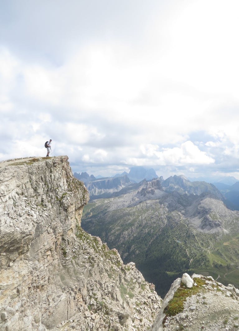
This time I could see the light at the end of the tunnel. I could see the mountain pass in the distance. I could see a person standing on the pass. A tiny speck on the horizon (top right photo). My eyes trailed to the left and what I saw shocked me. A grassy plateau spread out in all directions. It looked like a soccer pitch on a slant. Was that the peak? No, more like a saddle. A google search confirmed it.


It was Kamnik Saddle. I had never seen anything like it. I had a long traverse to get there, so I started down the trail at a quickened pace.


When I got to the plateau, I didn’t even take a moment to relish the fact that I conquered this mountain pass. Instead I B-lined for the grassy saddle. When I got there, I took off my bag and lay down on the grass. I have seen some truly amazing places in the Alps. The jagged rocks of the Dolomites. The serene lakes of Swiss Alps. All of it paled in comparison to this spot. As I lie there, on the grassy plateau taking in the surrounding countryside, I made out my destination hut in the distance. It was about 500 yards down the hill. It was an absurd place to put a hut, but it seemed to fit into the landscape like a puzzle piece. It belonged there. Of that, I had no doubt.


A giant Slovene Flag sat on the edge of the saddle looking off into the distance to places so far, it would take me a week to walk to. To the East giant, jagged mountain peaks lined the horizon. Wow. Wow is the only fitting word. I slowly made my way to the flag pole and then to the hut. About two dozen people sat outside drinking and eating. This was the busiest mountain hut I had been to so far. I was in the big boy mountains now, and it seems as if the Slovenians quite like the big boy mountains.


The historically dry summer meant no shower for me. Normally, that would damper my mood, but this mountain hut was special. I changed, then ordered some food. I was already hooked on Shandy’s, so I ordered one of those too. While in the hut, I noticed a visitor logbook. It had what seemed like 5000 pages. I signed my name and then started flipping through it. For every 10 names, 9 where Slovenians. I had to go back two years to find another American. I was shocked by the lack of foreign visitors. I was sure this was something that made Slovenians very happy. They had this special place all to themselves.


When I picked up my food I decided to ask the young women working there about the hike on stage 8. I had done some reading and I was a little worried that I didn’t have via ferrata gear. Everything I read said that via ferrata gear was recommended, but a helmet was nonnegotiable. That immediately scared me. That meant, lots of exposed hiking with people (and animals) above you. Loose rocks were typically the main cause of injuries up here and if someone or some animal knocked a rock down on you, there wasn’t much you could do to protect yourself.


“Do a lot of people hike to Cojzova Koca (stage 8) without via ferrata gear or a helmet,” I ask. She didn’t hesitate, “Of course people do.”. She said it so sternly, It almost seemed like I offended her with such a dumb question. This was the language barrier in full effect. I tried to restate my question, “Is it safe to hike without a helmet?” I rephrased. “ Of course it’s better to hike it with a helmet because of rocks, but people do hike it without one,” she replied with slightly less attitude than the first question. It was easy to mistake her response as rude, but I had been in the country for a while now. I knew this was not the case. I asked her one more question: “Would you hike it without a helmet?” I asked. “No” was her response. Greattttttttttttt.
As I sat outside enjoying my food and beverage I tried to think long and hard about what to do on stage 8. If I wasn’t solo, It would have been an easy answer. I would have gone. Having another person with you is at least as valuable as a helmet from a safety standpoint. I didn’t. It was a risk. It was a risk after 7 strenuous days of hiking. I would not be my fresh self. I was spent. Everything hurt. Was it smart to attempt this hike without the proper safety gear? It was the definition of a rhetorical question. Of course it wasn’t smart. The more appropriate question was do I attempt it anyway?
I also realized after reading up on my itinerary, that even if I completed stage 8, stage 9 was simply not doable. I learned this from listening to some Italian hikers discuss their itinerary. While I was able to increase my distance on the first 6 stages simply by starting early and ending late, I was in the big boy mountains now. There was no picking up the pace. I had to navigate via ferrata and exposed ridges for the next three days without safety gear. I didn’t like the options I had even if I managed to made it to Cojzova Koca on Stage 8. How would I change my itinerary from there?


In the end I decided it was too much of a gamble. I spent the next few hours coming up with plan B. I didn’t love what I came up with, but I am proud of myself for making a smart decision. I had a nice dinner and went to sleep on the top bunk in a room with 8 bunk beds. I fell asleep in seconds.


Stage 8: The Audible- Kamninska Koca to Kamnik
Breakfast was bittersweet. It was nice not to rush in the AM so that I could stay on schedule, but I felt like I was missing out on potentially the best hike of my life. I know that sounds crazy, but FOMO on mountain hikes is real. I left the hut and started my long descent down to civilization. "Plan B" required me to hike South for close to 17 miles to get to the village of Kamnik. There, I would rent a room above a pizza place. From there, I would figure out how to get to the airport the next day.


I enjoyed the close to 5,000 foot descent down to the valley floor. It was a long, but peaceful decent. Most importantly, it was shaded. I passed many a people on the way. I probably dished out about 50 head nods and a dozen dober dans. One gentleman stopped me to ask me a question in Slovenian. I was shocked. This was a first. To this point I had found people to be friendly, but indifferent. Slovenians were not the talkative type. I suppose that’s anecdotal at best, but it had taken 8 long stages and about 120 miles for someone to start a conversation with me. “Do you speak English,” I asked the man in response to the unknown question he asked. “Canadian,” he asked. “American,” I responded. His eyes lit up. “Wow” he said. “Why did you come to Slovenia?” I told him I had heard it was beautiful. “Where did you start,” he asked. I took this to mean my entire hike, but after responding I realized that wasn’t the case. “Maribor,” I said. He looked puzzled. “8 days ago,” I added. “Oh” he murmured. “You are going the wrong direction” he said with a smile. I knew immediately what he meant. Everyone was hiking up the mountain at this part of the day. No one was going down. Instead of explaining the entire story, I told him I had to catch a plane. He asked me where I started the day. "Kamninska Hut," I said uncomfortable with my pronunciation. He nodded. "How about the day before," he asked. “Solcava” I said. I pronounced the “c” in Solcava as I would the “c” in cat. This time he corrected me. “Sol Chava” he said with a pleasant smile. This is where I learned that “c’s” were pronounced as “Ch,” like in chunk. He then asked me which path I took. “Rinka Waterfall,” I responded. He glowed. He was clearly very prideful of his home country and in particular the mountains. He smiled and wished me luck on the rest of my adventure. It’s always nice to share an experience like that with someone from another country. It just goes to show you that we mountain hikers are not bound by our language or culture. We were of like mind, and we have a shared experience and love for the mountains. We have an unspoken camaraderie.


I continued on till the trail merged with a large parking lot. I spotted a hut with a beautiful outdoor area and headed there to take a break. As I walked I heard a helicopter taking off nearby. I immediately wondered if someone needed rescue. Perhaps on the very trail I had decided not to take today? Hmmmm. I sat at a table and ordered another breakfast and some coffee. The food was amazing.


The rest of the day would be following a river trail to Kamnik. I passed through a few gorges which were quite pretty. For the first few miles I encountered many hikers, but after a while, it was just me. The trail started to deteriorate and thin out making it difficult to find the way. Clearly, not many people hiked this part of the trail. I put my earbuds in for the first time on the trip. With each mile came an increase in temperature. Eventually the trail would come to a road, and I spent the last 5 miles walking down a country road in the heat of the day.


The road didn’t have a shoulder, but it didn’t matter much because there weren’t many cars. There weren’t many buildings either. It was hard to imagine why this place was so scarcely populated. The landscape was stunningly beautiful. Flat fields, well-kept homes and lots of cows. The Kamnik Mountains created a wall around this countryside. If this was real estate in the USA, it would have been jam packed with ugly mansions and vacation homes. There was something special about the emptiness of this place. I really enjoyed experiencing this little slice of Slovenia.


Eventually, the road collides with the small mountain town of Kamnik. I found my hotel/restaurant. I had a tiny little room that overlooked the main road. It was perfect. I spent some time wondering around Kamnik. I seemed to be a lovely place to live. Quiet. Pretty. There were a couple of grocery stores, a couple of restaurants and a nice little main street. Most of the real estate on Main St was empty. This made me sad for some reason. I liked Kamnik a lot. It was a cozy little mountain town with a lot of charm. I donned on me that my Slovenia experience was coming to an end. That made me sad. I was tired and worn down, but I didn’t want the trip to end. I ate dinner then went back to my room. I organized my pack and took another shower. After my shower I watched the local news. In the morning I would either walk or book a cab ride to the airport. I thought about this for few minutes before exhaustion kicked in and the sandman beckoned to me. I don’t remember how long It took me to fall asleep, but if I had to bet on it, I would say less than 30 seconds. I didn’t wake until the sun eclipsed the horizon and beamed through the sky light window that was a mere 6 feet above my feet. I didn’t need an alarm clock. The Slovenian sun did its job and woke me gently from my deep sleep. It was a new day, but for me it signified the official end of my solo trek on the Slovenian Mountain Trail.
Epilogue
Slovenia was different than my other European hikes. It’s hard to pinpoint why, but “different” is the appropriate word. I loved the country. I loved the mountains. I loved my experience there, but I wasn’t eager to go back and continue the hike solo. I started thinking about different options for 2027. Should I go back to Italy? Tackle the Alta Via #3? Should I go the UK and hike in the Scottish Highlands? Should I go to the Pyrenees or the Austrian Alps? I wasn’t sure what to do.
As time passed, the itch to go back to Slovenia grew, but I knew I didn’t want to do it solo. This is where I thought about the possibility of hiking it with my brother. I had spent the summer doing some intense hikes with him, but he was a bit of a wild card. I didn’t think he would say yes, so I was quite surprised by his response when I asked. We were driving in a car together. “You should really start wrapping your head about coming to Slovenia with me next year,” I said casually. He was quick to respond, “I’ll go,” he said.
The decision was made. I immediately started the planning. There was a lot to do over the next 11 months. As each month went by, the idea of going back to Slovenia fulfilled me.
Hiking with my brother brings upon a whole set of new challenges, but I didn’t care. I was going back to Slovenia and whatever obstacle I had to overcome would be worth it. Slovenia was not a good place to hike solo. Logistically speaking, it was a little too much of a challenge to take on. It was fine in the Pajorje hills, but the sections I would hike with my brother would be wrought with via ferrata, exposed ridges, tough scree switchback climbs and long waterless days. Ya, going with a partner was the key to success in the Slovenian Mountains. At least that’s what I told myself. I knew that the experience of hiking with my brother would bring with it some unconventional challenges, but I quickly did some math and determined it was well worth it. What did I mean by unconventional? Well, you will just have to read about it to find out.
-MikeHikesTheAlps, 2026

Contact
Questions or stories? Reach out anytime.
mikehikesthedolomites@gmail.com
© 2025. All rights reserved.
-MikeHikesTheAlps